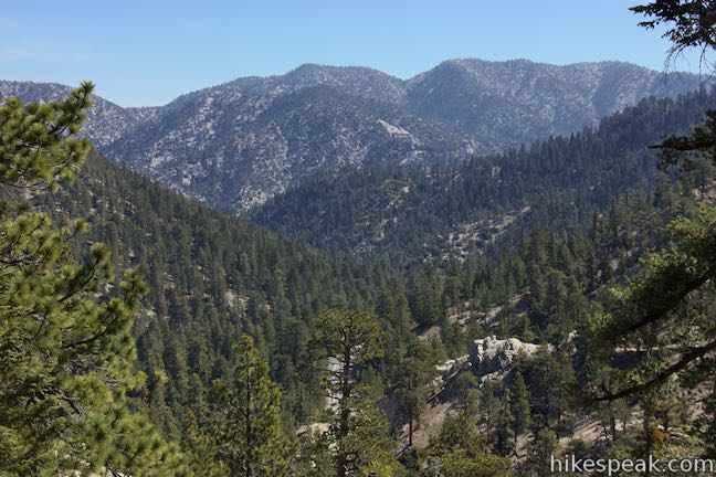
Because it’s possible to get permanently lost in the Mt. Waterman area of the Angeles National Forest, a hiker was lucky that someone in a different part of California had a hobby identifying the location of photos.
People have unusual hobbies, things they like to dig deep into just because. A stranger’s passion for figuring out where photos were taken turned out to be lucky for hiker Rene Compean. Sydney Page at the Washington Post has the life-and-death story.
“When Rene Compean snapped a photo of his soot-stained legs hanging over a steep cascade of rocks, he feared it was the last picture he’d ever take. Hopelessly lost while hiking in Southern California, he thought he might die. … He repeatedly yelled for help and used charred sticks to write SOS on any open surfaces he could find.
“Compean had trekked through the Angeles National Forest trails more times than he could count, he said, but after venturing along a new path April 12 — for what he intended to be a two-hour outing — he lost his way.
“Several hours into the solo hike, after many failed attempts at getting his bearings, he was scared. The temperature was dropping fast in the remote, rugged terrain, and the winds were whipping.
“Compean grabbed his cellphone, which had less than 10 percent battery remaining, and climbed to a spot where he was able to get at least one bar of signal.
” ‘SOS. My phone is going to die. I’m lost,’ Compean texted a friend, along with two photos showing where he was — though only one went through. It was the picture of his legs.
“The photo offered minimal information and, given Compean’s lack of cellphone signal, the resolution was very low. More importantly, though, Compean didn’t realize his location settings were disabled on his phone.
“Still, the grainy image was somehow detailed enough for a total stranger to decipher the hiker’s exact location.
“Ben Kuo was working at his home about 60 miles away in Ventura County, Calif., when he stumbled upon a tweet from the Los Angeles County Sheriff’s Department, along with the photo of Compean’s legs.
“The sheriff’s search-and-rescue teams had already spent the previous night unsuccessfully looking for Compean, so they released the photograph to the public hoping someone could help.
“Sgt. John Gilbert said they figured Compean was on the mountain at about 7,000 feet elevation, and the blasts of wind were ‘definitely a concern.’ …
“The department tweeted: ‘Are You an Avid Hiker in the Mt. Waterman Area? #LASD SAR Teams need help locating a #missing hiker.’
Kuo, 47, inspected the image and thought, ‘I bet I could find that spot,’ he recalled.
“Kuo works in the tech industry, but he is also an amateur radio operator. For several years, as a hobby, he has used his Twitter account to alert the public about natural disasters. He regularly examines satellite imagery to identify and track local wildfires.
“Plus, he has another unusual pastime: ‘I have always loved looking for where photos are taken,’ Kuo said. He frequently tries to identify where movie scenes, television shows or commercials were filmed. …
“So when he came across the blurry image of Compean’s legs surrounded by an endless landscape of rocks and vegetation, he instinctively pulled up a satellite map. Since the sheriff’s department said Compean’s car was found near Buckhorn Campground, he narrowed his search to the surrounding area.
‘There’s an amazing amount of information you can get from satellites,’ said Kuo, who is also a hiker, though he has never visited the area where Compean was lost.
“The first thing he noticed in the picture were patches of greenery. ‘I realized he’s got to be on the south side because there’s not really any green valleys on the north side,’ he explained.
“That finding tightened his search considerably and helped him zero in on one area that closely resembled the terrain in the image. The final step was cross-referencing the original photo with Google Earth and comparing specific details.
“ ‘By punching in the time and date that the photo was taken, you can compare the view in Google Earth,’ said Kuo. ‘They matched.’
“He shared a screenshot of the satellite imagery on Twitter and called the sheriff’s department to notify officials of the coordinates he uncovered.
“After vetting the findings in relation to the information they were able to glean about Compean’s whereabouts, ‘we felt pretty confident that Ben’s information was good,’ Gilbert said. A search-and-rescue team swiftly boarded a helicopter and flew to the area.”
Read what happened next at the Washington Post, here.


That is an incredible story of rescue. Wow that was lucky guy..
LikeLiked by 1 person
I picture him taking a few more precautions on future walks as I am sure he knows his survival was just a fluke.
LikeLiked by 1 person
Wow – exiting! I’m clicking on the link now to read the rest of the story 🙂
LikeLiked by 1 person
In scouts we were taught to mark trees to find our way back. Is no one doing that anymore?
LikeLiked by 1 person
Goodness, goodness! More folks who work with rescue should have this skill.
LikeLiked by 1 person
He could start a business to teach it.
LikeLiked by 1 person
Yes!
LikeLiked by 1 person
Wow! I love a scary story with a happy ending! I’ve been lost in the woods, only for a short time, but it is a very scary experience!
LikeLiked by 1 person
I have too.
LikeLiked by 1 person