Feeds:
Posts
Comments

Posts Tagged ‘boston public library’

Photo: Music & Youth.
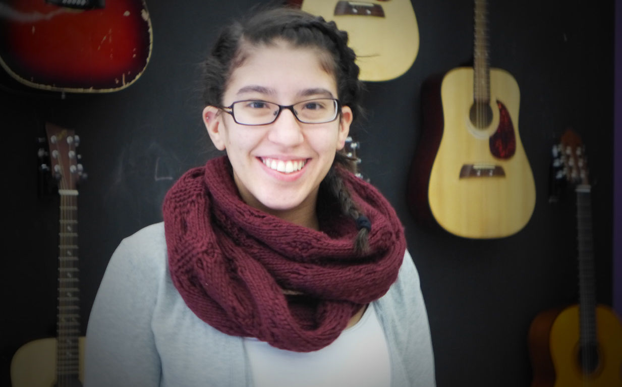
The Music Clubhouse, one of several music-focused hangouts for teens in Massachusetts, opened unexpected doors for Kristiana — forming a band, participating in a music event with the Red Sox, being accepted to the Berklee College City Music Program.

Teens always need a place to hang out with other teens. The centers in today’s story offer a lot more than hanging out.

Catherine Hurley writes at GBH radio, “Eden Troderman knew where she wanted to spend her first afternoon as a student attending the Berklee College of Music: at BTC Records, the music production space at the Brookline Teen Center that she knew well. …

“The Brookline High School graduate, who releases songs under the name Aruna, has been playing music her whole life — which included writing some ‘really cringey songs in sixth grade,’ she said. But [Aruna] didn’t start releasing music until receiving some help from BTC Records.

“Founded in 2013, the Brookline Teen Center offers a community hub for teenagers who live or go to school in Brookline. It’s one of more than 800 active youth development nonprofits in Massachusetts, according to ProPublica’s Nonprofit Explorer.

“On that cold and icy afternoon in January, the center was active with teens playing basketball in the gym and huddling around small tables with snacks after school. Others were working on music in the BTC Records studio space. …

“Bri Skywall, teen technology coordinator at the Boston Public Library, said the library’s Teen Central aims to ‘provide what we call the “third space”: a space that isn’t their home and isn’t school or work, that they can come and just be themselves.’ A space where teens ‘don’t have to pay to exist,’ she said.

“Third spaces, which broadly include include free and publicly available spaces, social services organizations and low-cost commercial establishments, are known to strengthen communities. But research shows third spaces are declining, and disparities are more present along income, race and geographic lines.

“Connections in these spaces are informal, but the plans to expand them are in writing. Strengthening the BPL’s role as a third space is listed in the city’s Imagine Boston 2030 plan. And Boston’s Third Spaces Lab, in collaboration with New Urban Mechanics, aims to ‘make it easier for grassroots organizations and individuals to grow and nurture community-based third spaces from the bottom up,’ according to the program’s website.

“BTC Music Coordinator Pablo Muñoz said the center’s goal has always been to develop a space where teens can make music, whether they have big dreams in mind or are looking to express themselves day-to-day. …

“ ‘Whenever they’re having maybe not the best week, they’ll come in here and they’ll be like, “I want to do a song. I want to talk about this.” … They’ll get it out, and then they feel better, and they’ll work on their craft,’ Muñoz said. …

“With 60-70 hours of work, Troderman writing and Muñoz producing, she released her first song, ‘Crave‘ last May, which recently surpassed 1,000 streams.

“ ‘It’s a small milestone, but it means a lot to me. If people are even listening to my music, that’s crazy,’ Troderman said.

“Tom Goldberg, a junior at Brookline High School, started taking a music production class with Muñoz in early November. He’s still learning the basics, he said, but Muñoz has already helped him create a vocal-less track, teaching him how to establish a beat.

“ ‘I think I’m more confident in myself,’ Goldberg said. … [He] said if he were to show people at school the music he likes, there would be a different reaction than at BTC Records. ‘Here, [it’s] way more welcoming,’ he said. ‘Like the sense of community is way bigger here.’ …

“Teens at the center that day milled in and out of the control room, pushing open the heavy, soundproof door in search of Muñoz, their admired teacher and collaborator. Muñoz himself started at BTC in 2022, about a year after he graduated from Berklee. …

“The next day, on a colder and icier afternoon in Back Bay, four teens huddled around computers and small keyboards. They were there for Music Production with Hamstank, a weekly digital music creation session at the Boston Public Library. Somerville-based record producer Tony ‘Hamstank’ Hamoui has led the program for the last seven years. …

“Hamstank’s routine during the hourlong sessions differs from week to week. Sometimes he’s helping teens get started — like a participant that day who opened the music software for the first time and was already making a song — but he also supports kids with more advanced music skills.

“Hamstank glanced over to another teen, calling him a ‘master-level composer and vocalist.’ The student was working on a song he started the week prior, this time re-recording vocals in the space’s audio booth. …

“Hamstank said some kids come to the session with their headphones on, wanting to work solely on their own projects. ‘And that’s fine, but you always find them slowly taking the headphones off and listening and asking questions and talking to other teens,’ he said.”

More at GBH, here. No firewall. [Note: I may have used the wrong pronouns for Troderman. The GBH article was inconsistent.]

Read Full Post »


Map: Athanasius Kircher, from Mundus Subterraneus (Amsterdam, 1665)
Beneath Our Feet: Mapping the World Below is on exhibit through February 25 at the Norman B. Leventhal Map Center, Boston Public Library.

You don’t have to be keen on fantasies like Alice’s Adventures Underground or Jules Verne’s Journey to the Center of the Earth to be fascinated by maps of the world below our feet.

That is why, as Allison Meier writes at Hyperallergic, the Boston Public Library (BPL) is sharing its amazing array of subterranean cartography — from mythology to science, from the God of Death in Pompeii to leaded water in Flint, Michigan.

“Only in recent centuries have cartographers visualized what’s underground,” she writes. “Early mapmakers employed mythology to explain the volcanic eruptions and earthquakes that seemed to erupt from some dark force, and sometimes swallow whole communities, like Pompeii or Herculaneum. Even now, our ability to delve below the thin crust on which we’ve built our civilization is limited by the intense pressure and molten magma that churns within the planet. …

“The Leventhal Map Center is exhibiting ‘Beneath Our Feet: Mapping the World Below,’ featuring 400 years of subterranean maps from their collections. These visualize volcanoes, catacombs, pipelines, mines, and seabeds, ranging from 19th-century geological surveys to 21st-century sensing technology. …

“ ‘We’re seeing that these maps were typically produced much later than the weather maps,’ [Stephanie Cyr, associate curator] explained. The exhibition is organized into different underground subjects, such as ‘Earth’s Crust,’ ‘Oceans,’ ‘Mining,’ ‘Archaeology,’ and ‘Beneath Boston.’ These are all further explored in an online component. …

“As soon as people found a way to map the Earth’s underground, they began to exploit it as a resource, drilling natural gas pipelines and digging coal mines.

“Yet as Cyr noted, ‘Before we could actually get down there and explore and survey it, people had to cope with things in the best way they could, and mythology helped people do that.’

“A 17th-century map on view, by Athanasius Kircher, has a tumultuous subsurface scene, with a ball of fire at the center of the Earth and all its bodies of water linked by underground waterways. …

“The maps in ‘Beneath Our Feet’ continue into the 21st century. … And (as the inclusion of maps of lead testing in Flint, Michigan, and the invasive technique of fracking remind viewers) this knowledge can have a significant impact on the lives of the people above.”

If you can’t get to the show, you can at least see some great underground maps here and explore the online features of the show.

Hat tip: Michelle Aldredge (@gwarlingo) on twitter.

Read Full Post »

Back in the day, a regular on the kids’ television show Howdy Doody was a putative Indian called Princess Summer Fall Winter Spring. The last two seasons in her name were run together as if they were one word.

Lately, “WinterSpring” seems to be the right name for what we’re experiencing in New England. Here are a few pictures from my confused season.

There are four photos of the beautiful Boston Public Library. The hardest shot to get was a lion not surrounded by photographers and visitors posing for their picture. While I was at the library, I was delighted to hear the retired Massachusetts chief justice being interviewed by Boston Public Radio, which sometimes broadcasts from there. Margaret Marshall is perhaps best known for her reasoning in the case to make gay marriage legal in Massachusetts. My photo of her friendly wave did not come out.

The ornate clock suddenly appeared on Washington Street. I don’t recall seeing it in all the years I took walks in that neighborhood.

The 5-lb coffee bag will get us through any kind of WinterSpring.

Finally, I include a couple indoor shots of my living room in a welcome shower of sunlight and a couple pictures of grandchildren managing just fine in WinterSpring.

Caroline is fine and let me know what flavor you want there is vanilla, chocolate, coffee, pineapple, and I expect your response many thanks Caroline

031717-library-courtyard-shadows


031717-rare-view-of-BPL-lion-sans-tourists

031017-snow-writing-ConcordMA


032017-thinking-beach-time-in-the-snow

031717-pastoral-reminder-re-love


031717-outdoor-clock-washington-st-boston

032317-coffee-in-5-lb-bag


032317-sunlight-thru-lattice

032317-rugs-on-wood-floor


032317-two-young-artists-sunny-day


Read Full Post »

And speaking of fairyland … would a map help?

You can view “Maps from Fiction” in the Boston Public Library’s Leventhal Map Center through October 25 — including a map of Fairyland, a map of Oz, and a map showing both Wild Island and the Island of Tangerina.

Mark Feeney writes at the Boston Globe, “Whether the places are real or imaginary, every map is itself a kind of fiction. Those lines and color shadings and cross-hatchings and numerals and words are as ‘real’ as the sentences in a novel or characters in a cartoon are.

“The London and southern England found in Holling C. Holling’s ‘Sherlock Holmes Mystery Map’ are as real as an order of fish and chips, but the events recorded on it aren’t. … The 100-Acre Wood of the Winnie-the-Pooh books are more familiar to some than their own backyards, in no small part thanks to the enchanting watercolors Ernest H. Shepard drew on its maps. What places are more vivid in the minds of readers than Midde-earth, Oz, Narnia, Neverland, H.P. Lovecraft’s Dreamlands, or George R.R. Martin’s ‘Song of Ice and Fire’ lands?”

Feeney’s article also muses about a Harvard exhibition of historical maps called “Finding Our Way: An Exploration of Human Navigation.” More here.

Illustration: Ruth Chrisman Gannett
Map from the storybook
My Father’s Dragon, by Ruth Stiles Gannett.

Read Full Post »