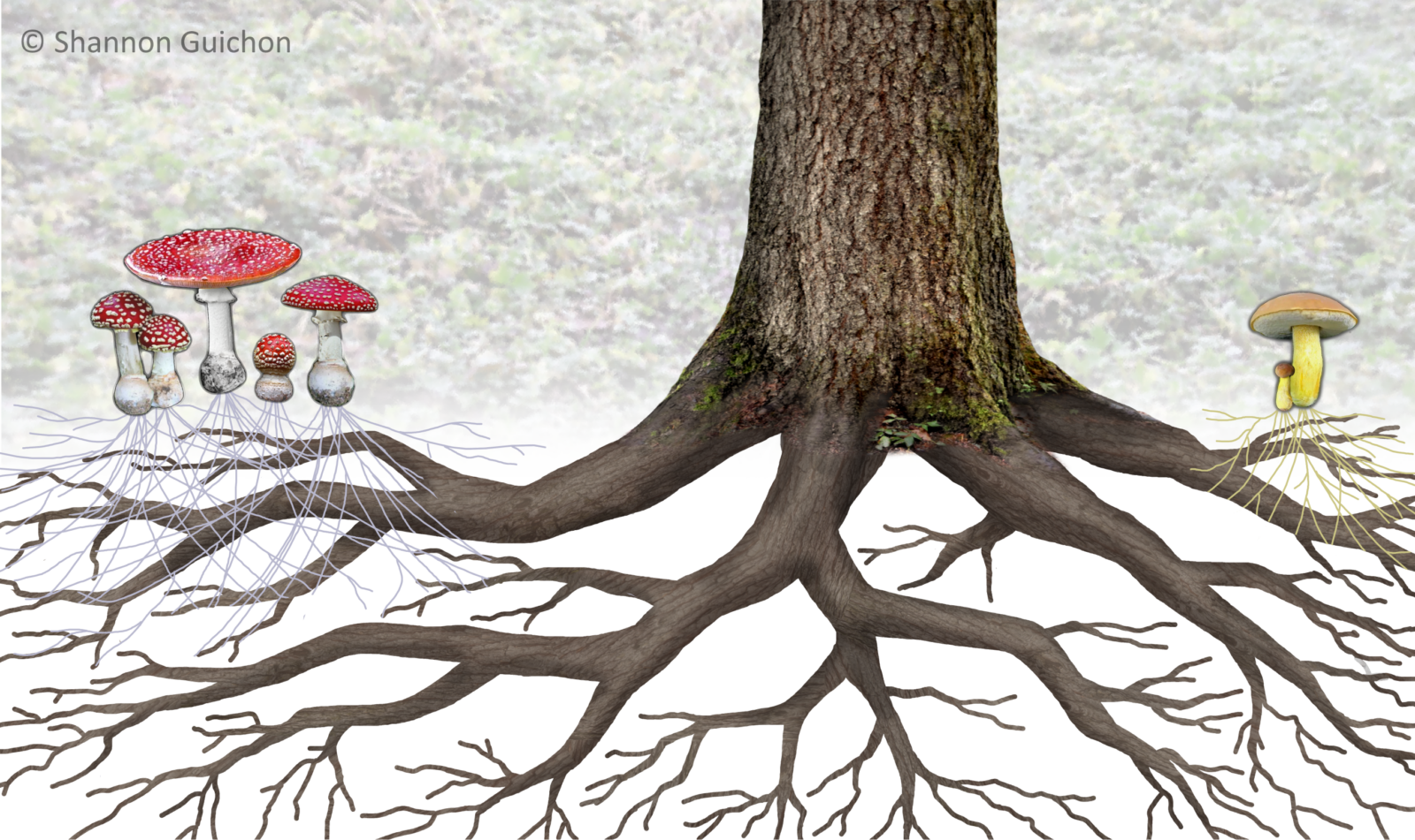
Photo: Dr. Shannon Guichon/National Forest Foundation.
Do you know about the “Wood Wide Web” (mycorrhizal network)? Fungus not only produces mushrooms (above) but connects trees and plants through tiny threads called mycelium.
Years ago, during one of our country’s endless wars over boundaries, I thought about earthworms and how they don’t recognize boundaries. I said to myself the world needed a kind of diplomacy that recognized what connects us instead of what separates us, Earthworm Diplomacy. After reading today’s feature, I’m thinking I should have focused on fungi.
In January “the Tyler Prize for Environmental Achievement, sometimes described as the ‘green Nobel Prize,’ was awarded to Toby Kiers, an evolutionary biologist at Vrije University Amsterdam who has spent the past three decades studying the workings and significance of the soil’s circulatory system.
Alan Burdick reported at the New York Times that “last year, Dr. Kiers won a MacArthur ‘genius’ award, as well as the Climate Breakthrough Award, sharing it with Giuliana Furci, a fungi conservationist, and Merlin Sheldrake, a mycologist at the University of Oxford.
“The fungal kingdom, which stands apart from plants and animals, contains anywhere from two million to five million species, including yeasts, mildew, lichens and mushrooms. Dr. Kiers studies mycorrhizal fungi, microbes that form vast, underground networks with carbon drawn from the roots of plants and trees, providing vital nutrients in exchange.
“Dr. Kiers and her colleagues have calculated that these microbial filaments, laid end to end, would span half the galaxy and that they sequester 13 billion tons of atmospheric carbon dioxide — one-third of the world’s fossil-fuel emissions — in the soil each year.
“These brainless, distributed organisms are also astonishingly strategic in their business dealings, her team has shown, imposing tariffs and inflating prices. In 2021, Dr. Kiers founded the Society for the Protection of Underground Networks, or SPUN, a global network of researchers and ‘underground explorers’ that works to identify and protect hot spots of fungal diversity. Last year they unveiled the first ever global underground atlas. And a new initiative called Underground Advocates, developed with the More-Than-Human Life program at the New York University School of Law, helps train scientists in legal and policy skills.
“In a recent video call, Dr. Kiers … said, ‘Fungi are usually the underdogs. The awards feel like an award for the invisible, the parts of the world that are challenging to understand, and a celebration of decentralized ways of thinking and operating that fungi have mastered.’ …
New York Times
Why fungi?
Toby Kiers
These underground ecosystems play a crucial role in regulating the climate. Soils store about 75 percent of Earth’s terrestrial carbon and contain close to 60 percent of Earth’s biodiversity.
Mycorrhizal fungi form the basis of food chains for those aboveground organisms, which together generate more soil and nutrients. They draw carbon from plants and get it to stick to minerals underground, where it’s hard to release back into the atmosphere.
The vast majority of crops form partnerships with mycorrhizal fungi and rely on them for their nutrients. Some beautiful experiments have shown that when plants interact with mycorrhizal fungi, they make bigger, sweeter flowers, which attract more pollinators.
These fungi also hold soil together; their bodies are woven into the aggregate and produce sticky chemicals that are hard to break down. Take away that scaffolding and soils would erode and disappear.
People think they know what soil and dirt is. With high-resolution imaging, we’re starting to make it visible and show that it’s alive. These are ecosystems, with as much complexity as what’s happening aboveground. I think 2026 is really going to be the year where people start talking about fungal restoration. It’s not enough to just add native plants to restore ecosystems; it has to be native plants together with native fungi. …
Times
How did you and fungi meet?
Kiers
When I was 19, I became so enchanted by the idea of being a field biologist that I left college, not knowing if I’d come back, and spent a year at the Smithsonian Tropical Research Institute, a research station on an island in the middle of the Panama Canal.
I needed a niche. At the time, mycorrhizal fungi were pretty unknown there. The older scientists were studying everything aboveground — trees, bats, primates. I started wondering what generated all that diversity. So I did an experiment with researchers where we took soil from underneath the trees of one species and used it to inoculate other tree seedlings to see if it would affect their growth.
We stained the roots with a dye, and you could see this intricate weave of fungi inside the cells — they penetrate it — called an arbuscule; it looks like a mini tree. That’s where nutrient exchange happens. And I could see that happening in the roots with my own eyes. …
Studies were starting to show that plants actually get huge benefits from fungi.
Later, I realized that they’re powerful actors in their own right. My Ph.D. thesis explored whether noncognitive organisms can discriminate between good and bad partners. For instance, from experiments, we know that plants will digest one of those arbuscules if they’re not getting enough phosphorus from the fungus; they can abort the interaction.
But the fungi make choices as well. We found that a fungus can avoid trading with plants in the shade, which have less carbon to trade. They trade differently depending on how many other fungal competitors are present. They can hoard resources in their network and artificially inflate the price. …
We’ve been studying fungal trade as an underground market and developing techniques to track, in real time, when and where important exchange deals take place, how fungi navigate space, how they decide when and how much carbon to send down each pathway, how they build their road systems and how they optimize that supply-chain design.
Are fungi capitalists? No. They’ve developed a system that is much more sophisticated than the economic system humans use. But it has allowed us to use economics as a mathematical framework to analyze these trade strategies, to make predictions and to see if the fungi follow them. The frontier is linking what we’re seeing on the micron scale to the global data to understand the role of fungi in the carbon cycle.
Times
Meanwhile, in SPUN, you’ve built a worldwide network of investigators to map the global distribution of networked microorganisms.
Kiers
We wanted to turn the traditional approach on its head. SPUN has become a rambunctious, decentralized community of people working together to study and protect underground fungi. We’re slightly outside academia while still adhering to rigorous science and publishing in top journals.
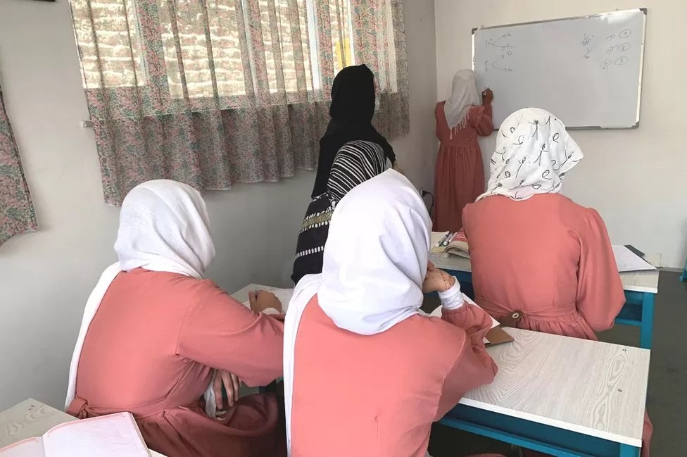
In 2022, we set up the Underground Explorers Program. It’s a network of researchers who are dedicated to mapping fungal biodiversity in their local ecosystems. We’ve given away 137 grants across 58 countries, 80 percent of them to researchers in the global south and more than half led by women. It’s a fungi-without-borders approach. For these scientists, climate change is not an option to care or not care about; it’s their survival, their livelihoods, with consequences that their children will inherit.
There’s a researcher in Mongolia who is trying to map and protect fungal communities that are threatened by desertification — fungi that hold the grass down and enable nomadic herders to continue grazing their animals. In Nigeria, a scientist named Bolaji Thanni is studying the effects of textile effluents on soil health to help advocate for stricter waste disposal regulations and the use of eco-friendly dyes. In Mexico, there’s a professional climber who is mapping mycorrhizal fungi along cliffs — which is just so unknown, right?
We’re a really scrappy organization. We’re super lean and mean; we don’t even have an office. We are everywhere and nowhere. That really helps us. In an academic setting, you almost have to know what you’re going to find before you’re funded to find it.
I use the term ‘punk science.’ We’re trying to cross boundaries and disciplines and not accept the state of the world as a given, while celebrating science that is rooted in creativity.
More at the Times, here.