Feeds:
Posts
Comments

Posts Tagged ‘tribe’

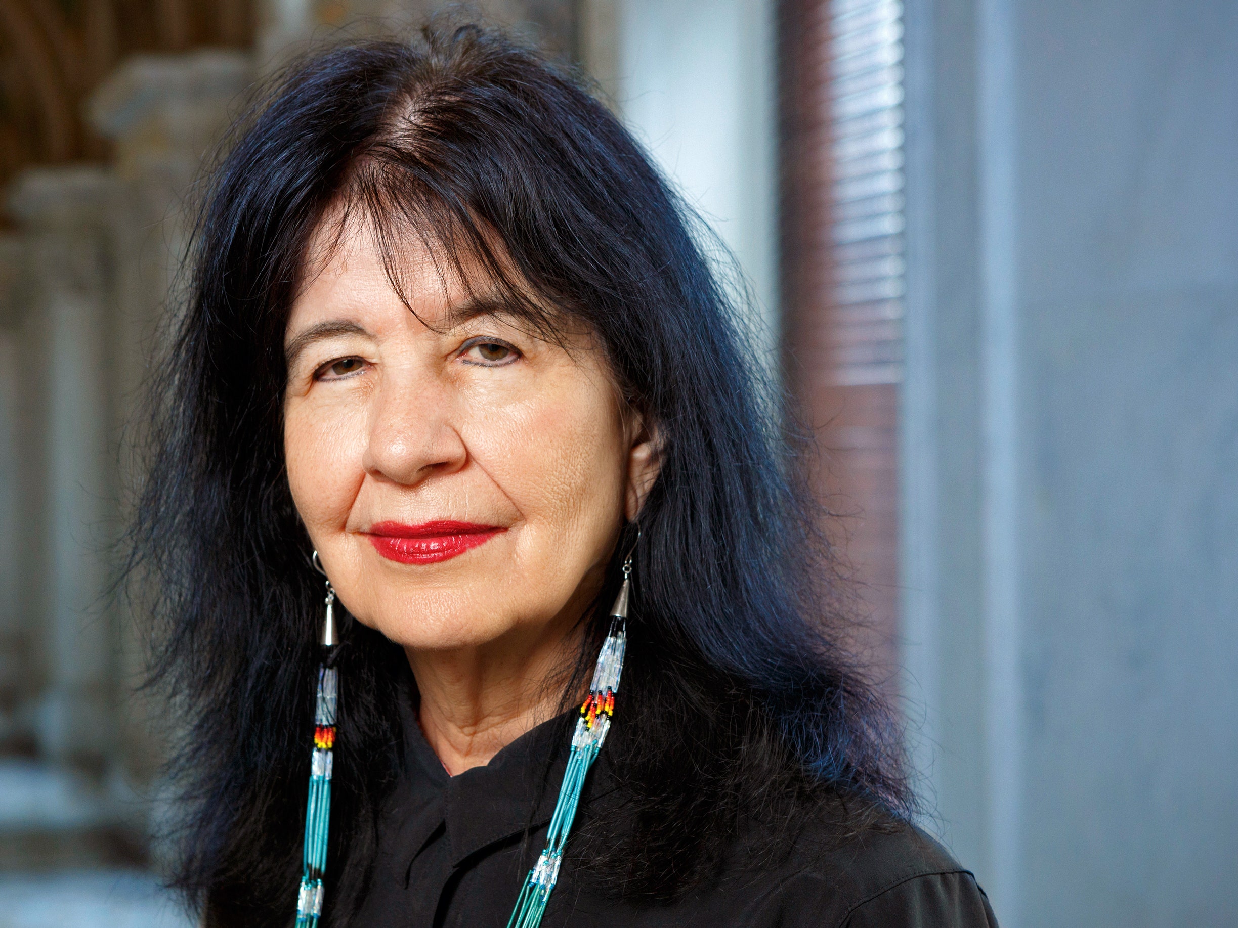
Photo: Caitlin Babcock/Christian Science Monitor.
Tami Graham, executive director of KSUT Public Radio, in her Ignacio, Colorado, headquarters.

It’s inspiring to see ordinary people trying to fill the gaps left by the withdrawal of government funds. But will it be enough? That is the question for the staff of a small but vital public radio station in Colorado.

Caitlin Babcock wrote in September at the Christian Science Monitor, “Crystal Ashike’s reporting for local radio station KSUT made national news when she broke a story on white vans that were showing up on Navajo land and whisking people away. The photojournalist, who is herself Navajo, uncovered how tribal members were being offered access to treatment for substance abuse, only to end up in fraudulent sober living homes.

“KSUT is an NPR-affiliate radio station that serves five counties and four tribes in southwest Colorado and northwest New Mexico, providing local news like Ms. Ashike’s story. And it’s [losing] nearly a fourth of its funding. ….

“Congress passed a rescissions bill this summer, clawing back nearly $1.1 billion in funding for public broadcasting. [The Corporation for Public Broadcasting], established by Congress in the 1960s, provides a small percentage of funding for NPR and PBS [and] also helps fund local radio stations like KSUT, which are affiliated with NPR and air some of its content alongside their own programming tailored to local communities. …

“[For] this station serving small mountain towns, there’s a lot of uncertainty. And for many in the community, it fills an indispensable role.

“ ‘I think we’d really be in a news desert for anything that mattered to us locally, regionally, if it weren’t for KSUT,’ says Carol Fleischer, a longtime listener.

“KSUT is based in Ignacio, a town of about 1,000 people in southwest Colorado that is also the headquarters of the Southern Ute Indian Tribe. The Southern Ute originally founded the station in 1976 to provide community news and traditional Native American music. At the time, it was one of only eight tribal stations in the country.

“After becoming an NPR affiliate in the 1980s, KSUT now runs two separate signals, with one exclusively dedicated to tribal news. The tribal signal broadcasts from 8 a.m. to midnight every weekday. Its programming is a compilation of news affecting local tribes, traditional music, and talk shows like a weekly broadcast on health issues affecting Indian Country.

“The second signal airs a morning regional newscast, a compilation of the station’s own reporting as well as collaborations with other Colorado stations. They also broadcast programming from NPR and BBC News, plus music handpicked by their DJs.

“During the summer – which in southwest Colorado means fire season – KSUT’s morning host puts together a list of updates on any fires that are burning and how effectively they’re being contained. When necessary, the station broadcasts live emergency and evacuation alerts. The fire season this summer has been a pretty intense one, says Tami Graham, the station’s director, with six active fires in the area.

“For some listeners, radio is the primary or only source for this kind of information. In the mountains and canyons of the KSUT broadcast area, cell service is ‘hit-or-miss,’ as one resident describes it. More than 20% of people in La Plata County lack reliable broadband service, meaning radio may be their only way to receive emergency alerts. …

“Like many stations around the country, KSUT has seen an outpouring of support in the weeks since the CPB announced its shutdown. Members have upped their monthly donations, many listeners are sending money for the first time, and the station has even had funds come in from people far across the country. …

“Even though KSUT doesn’t have immediate plans to cut programming, the funding cuts could damage their broadcasting ability. Early this year, KSUT was awarded a $500,000 grant – administered by the Federal Emergency Management Agency through the CPB – to update the technology that enables emergency alerts. But they never received any of the money. After six months of uncertainty regarding the funds because of a separate issue with FEMA, Congress passed a bill rescinding funding for the CPB, which then informed Ms. Graham that KSUT would have to spend any allotted funds by Sept. 30.

“The station paid $46,000 to buy a needed transmitter and other equipment. Three days later, the CPB told the station it would not be able to reimburse them before the shutdown, and warned them not to purchase any new equipment. …

“Priscilla Precious Collins, a member of what’s known as the Ute Mountain Ute Tribe, says KSUT is ‘one of the pillar sources of information in our community.’ She recalls how the radio was ‘crucial’ in spreading information to tribal communities during the pandemic, such as how to keep tribal elders safe. …

“On a baking hot morning in Durango, one of the biggest towns served by KSUT, 20 local listeners assemble in the dining room of a downtown hotel to share their thoughts on local radio.

“ ‘I was a schoolteacher for 37 years, and I listened to KSUT going to school and coming home,’ says Sweetie Marbury, a former mayor who organized the group. ‘It’s a window to the world for us that live in mountain towns.’ …

“On a recent morning, the KSUT broadcast pauses. ‘We have a very sad announcement,’ says Ms. Graham, the executive director. She tells listeners that one of the station’s DJs has unexpectedly passed away. …

“A listener writes in that afternoon. ‘I send my deepest condolences to you and to everyone there at KSUT,’ she writes, ‘as I know it is not just a business.’ In this woman’s 49 years of listening to KSUT, she says the station has been a ‘lifeboat in an angry sea.’ ”

More at the Monitor, here.

Read Full Post »

Photos: Ivan Vdovin/Alamy; Lyn Alweis/The Denver Post, via Getty Images.
With no known contemporaneous sketches or paintings of Sacagawea, artists have largely invented her look, even as historians have invented her story by relying on Lewis and Clark’s misunderstandings.

In a long article at the New York Times Magazine, Christopher Cox writes about researchers trying to piece together the real story of Sacagawea. Will these more-accurate accounts stick? As I learned when reading Josephine Tey’s mystery The Daughter of Time, truth may be “the daughter of time,” but popular legends are often too stubborn to die.

Cox writes, “In a conference room in the middle of the Great Plains, 50 people gathered to correct what they saw as a grave error in the historical record. It was July 16, 2015, on the Fort Berthold Indian Reservation in North Dakota, not too far upstream from the camp on the Missouri River where Meriwether Lewis and William Clark first met Sacagawea, the teenage girl who would accompany them to the Pacific Ocean and back.

“The story of that journey has been told many times: in the journals that Lewis and Clark kept; in more than a century of academic histories; and in countless more fanciful works that have turned the expedition, and Sacagawea’s supposed role as guide to the Americans, into one of the country’s foundational myths. The people in the conference room, members of three closely related tribes, the Mandans, the Hidatsas and the Arikaras, thought basically all of it was nonsense.

“Jerome Dancing Bull, a Hidatsa elder, took the microphone first. … ‘They got it all wrong!’ he told the people in the room, referring to the bare-bones, truncated life sketched out for Sacagawea by Lewis and Clark and the historians who followed them. In that telling, Sacagawea was born a member of the Shoshone tribe in present-day Idaho, was kidnapped by the Hidatsa as a child, spent most of 1805 and 1806 with the expedition and died in 1812, while she was still in her 20s. The Hidatsas insist that she was a member of their tribe all along and died more than 50 years later, in 1869. And not of old age, either: She was shot to death.

“History has always been a process; it has also long attracted partisans who insist that its judgments should be frozen in time. … Sacagawea long ago left the realm of the apolitical dead. Over the years, she has been pressed into service as an avatar of patient humility or assertive feminism, of American expansionism or Indigenous rights, of Jeffersonian derring-do or native wisdom. …

“The Hidatsas’ portrait of Sacagawea is both richer and more ambiguous than the one found in standard histories. By adding decades to her life, they have changed its meaning: The journey to the Pacific, rather than the whole of her existence, becomes a two-year blip in a story that stretches across the 19th century, from the opening of the Western frontier to the Civil War and beyond. Almost all those years were spent back where Lewis and Clark found her, among the Hidatsa.

“The meeting at Fort Berthold was organized by Dennis and Sandra Fox, married scholars who worked for the education division at the Bureau of Indian Affairs. Dennis is a direct descendant of Cedar Woman, whom the Hidatsas believed was Sacagawea’s daughter, born some 30 years after the Lewis and Clark expedition ended. He has heard about his famous ancestor since he was a boy, an oral tradition that included direct observations of her life long after her supposed death. That memory of her, he knew, was at risk of being lost. …

“The Foxes invited tribal historians and Hidatsa elders, many of whom believed themselves to be Sacagawea’s descendants, to speak. Everyone who participated got a Pendleton blanket. ‘It was a long day because we let everybody tell their stories,’ Sandra said. The discussion repeatedly veered away from the historical accounts of Sacagawea herself to more personal stories of what followed, in particular how the tribe’s memories of her had been suppressed in government and public schools. There she was called Sacajawea, with a J, and she was a Shoshone. …

“Some of those present wanted to make a film putting forward their version of Sacagawea’s life. But Gerard Baker, a former superintendent of the National Park Service’s Lewis and Clark trail, suggested that a book might be a better approach. ‘The first thing we learned in academia,’ he said, ‘is if we see something written, we believe it.’

“It was an early hint of a theme that would come to define the work that followed: the long-running historical debate over the relative value of oral and documentary evidence. In the moment, though, no one doubted Baker’s judgment. The tribal government agreed to fund research toward a book, with Dennis and Sandra Fox managing the project. The initial grant was for $30,000.

“Before the meeting ended, the Foxes chose five Hidatsa elders to serve as an advisory board: Baker, Calvin Grinnell, Bernie Fox, Wanda Sheppard and Carol Newman. Though the book would be credited to them, as the Sacagawea Project Board of the Mandan, Hidatsa and Arikara Nation, it was Dennis and Sandra who would do most of the writing. …

The board members themselves were important sources. Newman, one of the last surviving native speakers of Hidatsa, had polio as a child, which meant she spent an unusual amount of time among elder caregivers. From them she learned not only about Sacagawea’s life but also about the whole deep history of the Hidatsas, a tribe of farmers and buffalo hunters that, together with the Mandans and Arikaras, dominated trade on the Great Plains before the arrival of the Europeans. In passing along these oral histories, Newman was careful to cite her sources, most notably Philip Snow, her grandfather. ‘He’d describe it in our language,’ she said, ‘and I could see it.’

“Ultimately, the process of researching, writing and publishing the book stretched over six years and would cost some $250,000. ‘There were many nights when we thought, What have we done?’ Sandra said. ‘This story is just too complicated for anybody to understand.’ By 2020, though, they had a manuscript ready.

“The Foxes sent the book to a few independent and university presses but were dispirited by the responses. Even in written form, no one seemed to take their testimonies seriously. They felt themselves at a dead end and worried that the book might never reach the public. To the project board, it was a familiar result. … ‘the century-long efforts of the Hidatsa to overcome the power of the Lewis and Clark journals.’

“Academic historians have come a long way since, as E.H. Carr put it, they treated the past like a collection of facts ‘available to the historian in documents, inscriptions and so on, like fish on the fishmonger’s slab.’ For Lewis and Clark scholars, though, the journals have an irresistible pull that no oral history can match: an illustrated, contemporaneous, day-by-day account of the journey. ‘It’s something you can put your hand on,’ said Gary Moulton, the editor of the definitive version of the journals. ‘You can trace its lineage.’ …

“After a year of trying, in 2021, the Sacagawea Project Board found a small press in California, the Paragon Agency, that agreed to publish the book, with a long title drawn from Dancing Bull’s speech at Fort Berthold: ‘Our Story of Eagle Woman: Sacagawea: They Got It Wrong.’ In one of the few reviews the book received, Thomas Powers, the author of a well-regarded book about Crazy Horse, wrote, ‘One way or another, every future history’ of Sacagawea ‘will have to take it into account.’ ”

Lots more at the Times Magazine, here.

Read Full Post »

Photo: Jesse Casana.
Jonathan Alperstein, a researcher, excavates land on an unexpectedly large ancient agricultural site in Michigan.

The other day, my neighbor surprised me with a bunch of aerial photos of my New Shoreham place that were taken by her nephew’s drone. As drones are used more and more in warfare, I sure like thinking about the harmless and often useful things drones do.

In today’s example, a mystery revealed by drone led to a long-term collaboration between Menominee tribal members and non-Indigenous archaeologists in Michigan.

Nell Greenfieldboyce reports at National Public Radio (NPR), “Archeologists studying a forested area in northern Michigan say they’ve uncovered what is likely the largest intact remains of an ancient Native American agricultural site in the eastern half of the United States.

“The researchers used a drone equipped with a laser instrument to fly over more than 300 acres, taking advantage of a brief period of time after the winter snow had melted away but before the trees had put out their leaves.

“This allowed the drone to precisely map subtle features on the surface of the exposed ground, revealing parallel rows of earthen mounds. This is what’s left of raised gardening beds that were used to grow crops like corn, beans, and squash by the ancestors of the Menominee Indian Tribe of Wisconsin, in the centuries before European colonizers arrived.

“The mounds appeared to continue on beyond the surveyed area, the researchers say, showing agriculture at a surprisingly vast scale in a place that wasn’t a major population center.

” ‘We haven’t even been able to locate any significant settlement sites in this region. There’s a couple of tiny little villages,’ says Jesse Casana, a professor of anthropology at Dartmouth College and one of the authors of a new report in Science. ‘So it’s really shocking in this case to see this level of investment in an agricultural system that would require really enormous amounts of human labor to make happen.’

“It’s especially odd given the relatively poor growing conditions that far north, especially during a period of colder temperatures known as the Little Ice Age, as well as the presence of wild rice right nearby, says Madeleine McLeester, a Dartmouth anthropologist who led the research team. …

” ‘This astonishing paper shows how much we’ve underestimated the geographic range, productivity, and sustainability of intensive Indigenous agriculture across North America,’ says Gayle Fritz, an anthropologist with Washington University in St. Louis.

” ‘The study is outstanding in many ways, one being the long-term collaboration between Menominee tribal members and non-Indigenous archaeologists,’ she says — with the other being the combination of new technologies plus ‘old-fashioned, ground-based excavation and survey.’

“While some people may envision historical Native Americans as mostly hunter-gatherers or nomads, ‘that is very incorrect,’ says Casana. ‘By the time colonists arrived, what they were encountering were a lot of pretty sedentary communities all over North America who were practicing various forms of farming,’ he says. …

“The site mapped in this new study is part of Anaem Omot, which means the ‘Dog’s Belly’ in Menominee. It’s an area along the Menominee River on the border between Michigan and Wisconsin, and is of great cultural and historical significance to the Menominee tribe.

“The region contains burial mounds and dance rings. It’s also known to have agricultural ridges, ranging from 4 to 12 inches in height, because previous work back in the 1990’s had mapped some of them.

” ‘These features are really difficult to see on the ground, even when you’re walking around, and they’re difficult to map,’ says McLeester.

“That difficulty, plus concerns about proposed mining activities in the area, is why the research team — which included the tribe’s historic preservation director, David Grignon — wanted to see if new technology could reveal more acres covered with the earthen agricultural rows.

“McLeester says they thought they’d find some more rows, but also expected that others would have eroded away since the last mapping effort. …

“But the drone surveys revealed that the field system was ten times bigger than what had been previously seen. ‘Just the scale, I would say, was unexpected,’ she says. …

“Says Casana, ‘One of the interesting things about this study is that it kind of shows us a preserved window of what was probably a much more extensive agricultural landscape.’ …

Susan Kooiman of Southern Illinois University, an expert on the precontact Indigenous peoples of Eastern North America, says … ‘To find intact, ancient indigenous agricultural fields in any state, at any level, is very rare. …

” ‘The amount of work, and just how far these fields extend, is beyond anything that I think people suspected was going on this far north in eastern North America,’ she says. … ‘The question now is, what are they doing with all this stuff they were growing?’ “

More at NPR, here. (NPR is struggling since the massive federal cut. Help them out here if you can. No amount too small.)

Read Full Post »

Photo: San Francisco Chronicle/Hearst Newspapers/Getty Images.
Leaf, Lisa and Chaas Hillman look on as construction crews allow the Klamath River to run freely for the first time in nearly a century, near Hornbrook, California, in August. 

Everything done to Nature for human convenience has a downside. We have dammed up many rivers over the years for water reservoirs and electricity, flooding whole ecosystems. In the last couple of decades, though, we’ve been trying our best to restore what was lost, often with the guidance of indigenous tribes that always knew better.

Gabrielle Canon has one story at the Guardian.

“Explosions roared through the canyons lining the Klamath River [in 2024], signaling a new chapter for the region that hugs the Oregon-California border. In October, the removal of four hydroelectric dams built on the river was completed – the largest project of its kind in US history.

“The blast of the final dam was just the beginning. The work to restore the river, which winds 263 miles (423km) from the volcanic Cascade mountain range in Oregon to the Pacific coast in northern California, is now under way. …

” ‘It has been more successful than we ever imagined,’ said Ren Brownell, the spokesperson for the Klamath River Renewal Corporation, a nonprofit created to oversee and implement the removal. …

“The Klamath River was once an ecological powerhouse – the third-largest salmon-producing river in the American west. Its basin covered more than 9.4m acres (3.8m hectares) and its network of wetlands was the largest in the region. The ecosystem was home to millions of migrating birds. Tribes, including the Hoopa, Karuk, Klamath, Modoc and Yurok, thrived in this bountiful and beautiful watershed for thousands of years, with the river providing both sustenance and ritual.

“Over the last hundred years, these landscapes have been drastically altered.

“After the first dam began operating in 1918 – one of four that would eventually be forged in the lower Klamath to provide hydroelectric power to communities nearby – the course of the river was changed. The dams obstructed the migration of salmon and other native species, which help carry nutrients into the systems from the ocean, to cascading effects.

“They also held on to huge stores of sediment that would otherwise have flowed downriver, and created shallow reservoirs that quickly heated when the weather warmed. Increased water temperatures in the river allowed toxic algal blooms to thrive.

“In recent decades, the climate crisis has turned up the dial, deepening droughts and fueling a rise in catastrophic fire as the region grows ever hotter. The impacts only increased as more water was diverted to support the farming and ranching in the region, and more habitat was altered by mining and logging.

“Twenty-eight types of salmon and steelhead trout, seen as indicator species that represent the health of the ecosystems they live in, have been listed as threatened or endangered.

“As the Klamath ecosystem deteriorated, there was growing recognition that removing the dams would be a crucial first step in helping the region recover and build resilience in a warming world.

“But, faced with a strong resistance to change in local communities tucked around the reservoirs and a long history of difficult battles over water in the parched landscapes in the west, dam removal seemed all but impossible. The land for the dams was taken from tribes during the throes of colonization and development and more recently supported energy corporations that had shareholders to answer to.

“Then, in 2002, disaster struck. Algae flourished in the shallow warming waters that year, exacerbated by the dams and decisions from the US Bureau of Reclamation to divert vital flows to farms, leaving little for fish. The event killed 70,000 salmon and thousands of other species, resulting in one of the worst die-offs ever to occur in the US.

“The layers of fish floating belly-up sent an important signal of the horrors that could continue into the future if the dams remained. Forming a coalition, tribes up and down the Klamath launched a fierce campaign to educate the public, inform the shareholders of the companies that owned and operated the dams, and petition their boards. They protested and attended public hearings, and engaged with state and federal officials.

“It took decades of advocacy to convince PacifiCorp, a subsidiary of Berkshire Hathaway Energy, to let go of the aging infrastructure straddling the Oregon-California border. But in the mid-aughts, assured by shifts in public opinion and incentivized by the steep costs to relicense the dams, the company agreed it was time to see them go.

“In November 2020, nearly 20 years after the die-off, an agreement was forged between a long list of stakeholders that included tribal and state governments and federal agencies. The Klamath River Renewal Corporation was created to oversee and implement the removal.

“The organization had to help bring residents near the reservoirs onboard, navigate dozens of species-management plans, and model how outdoor-recreation enthusiasts could continue to enjoy the river. Ranchers and fishers, environmentalists and farmers, and locals and visitors all had connections to the basin, and were eager to weigh in. …

“Brownell, who grew up along the riverbanks, was standing in the canyon as the blast of the first dam released flows and the river that had been held over the last hundred years found its way back to itself. …

“There were moments of trauma along the way. Over the 100 years the dams were standing, they had held back 15m cubic yards of sediment. When the dams were removed, the heavy dead organic matter had to run downriver, soaking up oxygen in the water. Extensive modeling had predicted a severe impact on aquatic life, but no one knew how bad it would get or how long it would take for the river to regain its health. Some models predicted the suffocating conditions could linger for up to a month.

“ ‘I was braced and prepared but it was still tremendously hard,’ said Brownell, recalling how the water, rid of oxygen, looked like oil as it cascaded through its banks. ‘You can easily compare a river’s health to an individual’s health,’ she said. ‘Often when someone is sick, they are going to get worse before they get better. … The whole time everyone was so excited because it felt like the start of something – I just felt sick,’ she said.

“Leaf Hillman, a Karuk tribal ceremonial leader who has dedicated decades to seeing this project come to fruition, helped keep hopes high with assurances that these were signs of healing.

“ ‘For me it was beautiful,’ he said, recalling how he felt even when the rushing waters became clouded by silt. ‘I could envision what it was going to look like – a restored river.’

“In the end, the river lacked oxygen for only two 24-hour periods, a far shorter time than scientists had feared.”

At the Guardian, here, you can read what happened next. No paywall.

Read Full Post »

Photo: Erin Braaten/Dancing Aspens Photography via AP.
A rare white buffalo calf in Yellowstone National Park in Wyoming on 4 June 2024. 

In the early days of TV, a show we watched regularly was Rin Tin Tin. It featured a dog and a boy and the US Army patrolling out west. I’m sure there were many elements that would be considered offensive today, but you know, children pick up nice things from anywhere. I can still sing the song about the White Buffalo.

After a white buffalo was born in June, Oliver Milman wrote about the event at the Guardian.

“A rare white buffalo has been born in Yellowstone national park, with the arrival prompting local Lakota Sioux leaders to plan a special celebration, with the calf representing a sign of hope and the need to look after the planet.

“The white calf was reportedly spotted shortly after its birth … by park visitor Erin Braaten, a photographer. She took several shots of the wobbly baby after spotting it amongst a herd of buffalo in the north-eastern corner of the large park, located in Wyoming and a small slice of Montana.

“ ‘I couldn’t believe what I was seeing,’ Braaten told ABC News. ‘It was so surreal. I just knew it was something special and one of the coolest things I’ve ever photographed.’

“Braaten and her family watched the calf and its mother for another half an hour before coming back on each of the following two days to look for the white calf, but with no further sighting. …

“Members of the Lakota Sioux tribe will hold a ceremony to celebrate the arrival at the headquarters of the Buffalo Field Campaign, which advocates for the animals, in West Yellowstone on 26 June.

“The birth of a white buffalo holds a special significance to the tribe, according to the Buffalo Field Campaign. ‘The birth of this calf is both a blessing and warning. We must do more,’ said Chief Arvol Looking Horse, the spiritual leader of the Lakota, Dakota and the Nakota Oyate in South Dakota, according to AP, referring to looking after nature and the environment.

“Tens of millions of buffalo once roamed the plains of the western US, only to be slaughtered on an enormous scale for their hides by settlers, hunters and traders in the 19th century, leaving just a few hundred of the animals unscathed.

“The mass killing of buffalo caused severe harm to native American communities that relied upon the animals as a sustainable food source, as well as being a key cultural touchstone.” More at the Guardian, here.

At a National Park Service (NPS) site, you can read a lot more about the legends surrounding the White Buffalo. For example: “To American Indians, a White Buffalo Calf is the most sacred living thing on earth. The calf is a sign to begin life’s sacred loop. Some American Indians say the birth of a white calf is an omen because the birth takes place in the most unexpected places and often happens among the poorest of people. The birth is sacred within the American Indian communities, because it brings a sense of hope and is a sign that good times are about to happen.” More at NPS, here.

If you go to the YouTube clip below, you will see many happy comments from people who loved the Rin Tin Tin episode about the White Buffalo when they were kids.

Read Full Post »

Photo: Josh Miller via American Rivers.
Klamath River, California.

We have a lot of dams in this country that are now under consideration for removal, sometimes to restore land to tribes, sometimes to benefit wildlife, often for a combination of reasons.

Debra Utacia Krol of the Arizona Republic writes at AZCentral, “Tribes and environmentalists cheered last month as crews blasted out the concrete plugs holding water behind the JC Boyle and Copco I dams, the largest of four decommissioned dams on the Klamath River, allowing silt-filled water to flow down the ancient riverbed.

“Hope also flowed downstream alongside the muddy waters that the gigantic removal project supercharges the goal of restoring the environmental health of the river basin that traverses Northern California and southern Oregon.

“The water that once covered over 2,000 acres of land surrounding the river has begun to recede, revealing artifacts like old farm equipment, foundations and bridge pilings left over from pre-dam days. But local residents worry about the fate of local wildlife like deer and eagles that get stuck in the muddy grounds and mourn the loss of non-native fish that inhabited the reservoirs’ warm-water layers.

“The tribes, environmentalists and their allies celebrated the shrinking waters as an essential next step in what they say will be a decades-long process of restoring one of the West’s largest salmon fisheries and a region the size of West Virginia back to health.

“Yurok tribal member and fisheries director Barry McCovey was amazed at how fast the river and the lands surrounding the Copco dam were revealed. …

“The 6,500-member tribe’s lands span the Klamath’s final 44 miles to the Pacific Ocean, and the Yurok and other tribes that depend on the Klamath for subsistence and cultural activities have long advocated for the dams’ removal and for ecological restoration.

“Amid the largest-ever dam removal in the U.S., rumors and misunderstandings have spread through social media, in grange halls and in local establishments. In the meantime, public agencies and private firms race to correct misinformation by providing facts and real data on how the Klamath is recovering from what one official called ‘major heart surgery.’ …

“Residents and curious tourists were alarmed to see gray, sticky mud flats and masses of dead fish where the reservoirs once filled the canyons. They also were shocked to see brown, silty water running down the now-exposed river bed, miring deer in the mud. Social media feeds lamented the scene and claimed the ecosystem had been destroyed, possibly forever.

“But the people and organizations that had planned the removal had also forecast what would most likely happen after draining the reservoirs and said what looked like a gruesome scene was expected — and temporary.

” ‘Everything we’re seeing is exactly what has been predicted,’ said McCovey, adding that the large amounts of sediment moved by waters pouring out of two tunnels blasted underneath JC Boyle and Copco I dams were accounted for during the planning process. …

“The sediment now making its way to the Pacific was always destined to wind up in the ocean, he said, just as the fish convey nutrients upstream. McCovey likened the system to how the human body works.

” ‘The river is like the arteries of the earth, and the water would be the blood,'”‘ he said. And just as how a human body functions, blood transports vital elements throughout the body, McCovey added. When arteries are blocked, blood can’t convey nutrients or carry off waste, resulting in disease. ‘When you have such a blockage, you need to have surgery to have that blockage removed,’ McCovey said. …

” ‘After the river makes a full recovery, it’ll be much healthier,’ McCovey said.

“The Yurok Tribe also contracted with Resource Environmental Solutions to collect the billions of seeds from native plants needed to restore the denuded lands revealed when the waters subsided.

“The company, known to locals as RES, took a whole-ecological approach while planning the project. In addition to rehabbing about 2,200 acres of land exposed after the four shallow reservoirs finish draining, ‘we have obligations for a number of species, including eagles and Western pond turtles,’ said David Coffman, RES’ Northern California and Southern Oregon director.

“The plan included anticipating the effects removal and restoration could have on water quality and temperature, aquatic species and other species. … The company also plans to support important pollinators like native bumblebees and monarch butterflies and protect species of special concern like the willow flycatcher. And, Coffman said, removal of invasive plant species like star thistle is also underway. In some cases, he said, workers will pull any invasives out by hand if they notice them encroaching on newly planted areas.”

The long and interesting article at AZCentral, here, covers complaints by people who felt they were not in the loop and were adversely affected, what was done to compensate them and also rescue trapped wildlife, and goals for the future.

Read Full Post »

Photo: TJ Watt/Ancient Forest Alliance.
Ancient Forest Alliance photographer TJ Watt and an ancient Western red cedar. The tree is estimated to be 46 metres high [150 feet]. It is located on Flores Island, in Clayoquot Sound off Vancouver Island in the territory of Canada’s Ahousaht tribe. 

I love reading about unusual careers and pursuits people have devoted their lives to. There’s so much to learn!

Chad Pawson reports at Canadian Broadcasting (CBC) about a guy at the Ancient Forest Alliance in Canada who hunts down big, old trees. Although the local indigenous people probably always knew about the tree he calls “The Wall,” it can’t hurt to teach others about why it needs protection.

“For 20 years, Victoria’s TJ Watt, 39, has trekked through the province’s vast and verdant landscape seeking out giant, old trees to document them and make a case for their conservation. Now, at a time when exceptionally large trees have dwindled due to logging, he’s recorded what he calls the tree of his lifetime.

” ‘No tree has blown me away more than this one,’ he said. ‘It literally is a wall of wood.’

“Watt photographed the tree, a Western red cedar, in 2022 on Flores Island in fabled Clayoquot Sound on Ahousaht First Nations territory while on a field trip as a National Geographic and Royal Canadian Geographical Society explorer. (The species is also spelled redcedar because it’s not deemed to be a true cedar.)

“It’s estimated to be 46 metres tall [151 feet] and five metres wide at its base. The old-growth tree, part of forests that store carbon and support many species of plants and animals, is estimated to be at least 1,000 years old, according to Watt.

“Its dimensions put it at the very top of the biggest and oldest trees in the province and across Canada.

” ‘Unlike most other trees, it actually gets wider as it goes up,’ said Watt. …

“Watt and the Ahousaht First Nation have now revealed images and details of the tree to the public — although keeping its location secret — to show it as an example of the importance of the province meeting commitments to overhaul forestry to balance harvesting with ecological values.

” ‘It’s representative of a healthy, intact, coastal, temperate ecosystem,’ said Tyson Atleo, 36, a hereditary representative of the Ahousaht First Nation. ‘We don’t see a lot of trees that size anymore.’

“The tree has been nicknamed ‘The Wall or [a word meaning] ‘big redcedar’ in the Nuu-chah-nulth language. It’s in a type of forest that’s in danger of disappearing from B.C.’s landscape due to a history of intense logging. …

“The tree is not currently in danger of being logged as it’s in an area where old-growth logging is being deferred as part of work between First Nations and the province to protect old-growth forests at risk of permanent biodiversity loss.

“The Ahousaht First Nation, whose territory spans Clayoquot Sound, a globally recognized biosphere reserve, is at the forefront of work to keep significant trees in biodiverse forests standing while finding other ways, such as tourism, to replace lost revenues. …

“Ahous Adventures, an Ahousaht-owned and operated eco-cultural tour company in Tofino, won’t be taking visitors to the tree in order to keep the area protected but does other tours to show off the region’s other impressive trees.

“Nations like the Ahousaht are hoping for more conservation funding from the province to be able to develop [alternatives to logging]. …

“In order to raise funds on its own, the Ahousaht has established a voluntary stewardship fee for its territories, much like B.C. Parks’ day-use passes.

“Meanwhile, others also making careers of trying to locate and document massive old-growth trees that still exist, say coming across trees like The Wall is akin to a religious experience.

” ‘You feel so small, and you realize it is so incredibly important what these things are. They represent so much more than just a tree. It’s an ecosystem unto itself,’ said Colin Spratt, a conservation photographer who takes people on tours of Vancouver’s Stanley Park to show off old-growth trees there.”

More at the CBC, here. Other details at the Washington Post, here.

Read Full Post »

Photo: Mark Elbroch.
Since 2018, the collaborative Olympic Cougar Project has tagged 111 individual pumas, including Charlotte, above.

How many names do you know for the animal in the picture above? I learned four from today’s article.

Stephen Humphries writes at the Christian Science Monitor, “If Kim Sager-Fradkin didn’t have to write a grant proposal, she’d be spending her afternoon on the trail of a killer. 

“The biologist leads a team that’s researching cougars in Washington’s Olympic Peninsula. (The big cat is also referred to as a puma or a mountain lion. Not to mention wild cat, or panthera.]) Today, the team is tracking a cougar named James. It suspects he recently hunted an animal in a nearby forest. 

“ ‘Visiting cougar kill sites is really fun and like being sort of a forensic scientist,’ says Ms. Sager-Fradkin … wildlife program manager for the Lower Elwha Klallam Tribe. She’s overseeing the Olympic Cougar Project in partnership with Panthera … and five other Native American tribes. They’ve pooled their talents and resources to help an apex predator that has become effectively imprisoned in the westernmost part of Washington. 

“The region’s cougars are penned inside a geographical island roughly shaped like a square. Three sides are bordered by the ocean and bays. To the south there’s the expansive Columbia River as well as Interstate 5. The barriers on all four sides collectively form a de facto fence. Unable to easily connect with other big cats in the Pacific Northwest, cougars in the Olympic Peninsula are inbreeding. The lack of genetic diversity poses health challenges for them, scientists say. By collecting data on the big cats, the Olympic Cougar Project is bolstering the case for constructing a wildlife overpass over I-5 so that the species is less confined.

“ ‘Humans love wildlife stories, and humans love wildlife movements,’ says biologist Jim Williams, author of Path of the Puma: The Remarkable Resilience of the Mountain Lion. ‘What’s really neat about this project is it’s going to create information that will be translated through story that will keep humans excited and caring about the species.’ …

“When Ms. Sager-Fradkin began working for the tribe in 2007, her primary role was to plan sustainable subsistence hunting and fishing for current and future generations. A year later, she initiated a small-scale study of cougars in the region. She called in cougar expert Mark Elbroch. In 2018, they expanded the scope and scale, incorporating the five other tribes in the region and adopting the Olympic Cougar Project name. 

“ ‘The tribes on the peninsula aren’t always working together on a lot of things,’ says Ms. Sager-Fradkin, adding that there are sometimes disagreements over issues such as hunting jurisdictions. ‘So it’s really amazing that we’ve all come together and are working on a big project like this.’  To get all the partners on board, she had to get them to see the big picture. …

“The cougars are considered an ‘umbrella species’ because so many other creatures in the ecosystem depend on them. ‘Where there are frequent kills, the grass is literally more nutrient rich,’ explains Ms. Sager-Fradkin. …

“It was this fact that helped her persuade the region’s tribes that it was in their common interest to study the feline carnivore. 

“For his part, Dr. Elbroch, director of the puma program at Panthera, adds that Ms. Sager-Fradkin used her natural skill of engaging with people. …

“Working in concert, the Skokomish, Makah, Quinault, Jamestown S’Klallam, and Lower Elwha Klallam tribes have created a grid consisting of 550 cameras. Artificial intelligence catalogs animals photographed in the peninsula – including bobcats, bears, coyotes, deer, and elk – and helps estimate their populations. Research technicians, such as Lower Elwha Klallam tribe member Vanessa Castle, analyze the patterns of 127 individual cougars. There’s also the less glamorous task of analyzing animal scat. 

“ ‘A lot of our ancestral knowledge was lost,’ says Ms. Castle, who praises how Ms. Sager-Fradkin has mentored her and other employees in the project. ‘So we’re having to relearn those things. Like how wildlife all is intertwined with each other. … I had no idea the role that mountain lions played in the system as a whole.’ …

“ ‘The first thing that is needed is to protect the habitat on either side, because you can’t spend all the money on a wildlife bridge and then end up with a Walmart parking lot right on one side,’ says Ms. Sager-Fradkin. 

“The Olympic Cougar Project is not just liberating the big cats, she adds, but also creating a sustainable ecosystem for the tribes for the next seven generations.”

More at the Monitor, here. No paywall. Subscriptions encouraged.

Read Full Post »

Photo: Dave Herasimtschuk, US Fish & Wildlife Service/Wikimedia.
In Washington State, the Yakama Nation Fisheries crew routinely teams up to catch lamprey at an “eeling” hole that’s fed tribal members for generations. Lamprey use the suction of their oral discs to climb rocks at the eeling hole.

I like to explore social media and recently added Mastodon to the places I visit. At Mastodon, you have to join a group (what they call an instance), and I chose the Climate Justice instance. Being with Climate Justice has exposed me to people I haven’t followed before on social media. You won’t be surprised to learn that a topic like climate justice has attracted quite a few indigenous people. They are from all over the world: Sámi from the Nordic countries, Aborigine people from Australia, among others.

B. “Toastie” Oaster is one, a citizen of the Choctaw Nation in Oklahoma. From Toastie, I learned about a publication called High Country News and an article on the Pacific lamprey, an ugly fish with a long, important history.

“Lamprey have lived on Earth for 450 million years. To them, dinosaurs were a passing fad, and the North American continent is a fairly recent development. Lamprey swim out to sea as juveniles, looking for hosts like salmon to parasitize until they are mature enough to swim up some other river to spawn. Adult lamprey are calorie-dense and slow, protecting their hosts and cousins, the salmon, by acting as a predation buffer in another gesture of reciprocal care. 

“Though lamprey play a key role in Pacific watershed ecosystems, they remain understudied outside of tribal fisheries. They’re the target of misplaced disdain, in part because they’re easily confused with sea lamprey, an Atlantic species that caused ecological havoc in the Great Lakes after a 19th century shipping canal allowed them to invade. Pacific lamprey are a different species, in a different ecosystem; they belong here, just like the people they sustain.

“As far back as the memory archive reaches, people have fished for eels in this watershed. Lamprey climb wet rocks with their sucker mouths, so waterfalls are good places to catch them. Celilo Falls was a dangerous place for eeling, so people went to places like Willamette Falls, Celilo’s younger cousin. In its heyday, it was an international destination for summer eeling. Elders remember elders who remember trails that connected the falls to central Oregon. Camps lined both sides of the Willamette and the Clackamas River, which branches off below the falls. 

“Wewa [an elder and tribal councilman of the Confederated Tribes of Warm Springs] and other elders are clear that their ancestors were not nomads. Families returned to permanent homes, making seasonal trips to where food thrived. This non-European approach to agriculture ensures that both people and ecosystems flourish. In its healthy state, the Willamette Valley was a food-producing white oak savanna, bright blue in springtime with flowering carpets of delicious camas roots. That’s where it got its name: ‘Willamette’ is a French corruption of lámt, the Ichishkíin word for blue, Wewa said. ‘They ruined it.’

“For the millions of lamprey that returned from the ocean to spawn in the Willamette Valley, the first obstacle they faced was Willamette Falls. In the late 1800s, settler accounts described the 1,500-foot-long, four-story-high falls as ‘completely covered‘ in eels during the summer runs — three layers deep, in some places. Historical photos give an idea of how the rocks looked blanketed in eels, some latched onto each other’s backs, rendering the boulders as shaggy as mastodons. In the 1940s, European settlers commercially harvested as many as 500,000 lamprey a year, but tribal harvests until that point had kept the population in careful balance. …

“Since industrialization, lamprey numbers have dropped by 90%, largely because of dams. According to some Natives, public antipathy toward the species hasn’t helped. Willamette Falls is one of the last places where there are still enough lamprey to harvest. There, the Confederated Tribes of the Umatilla Indian Reservation, the Confederated Tribes of Warm Springs, the Confederated Tribes and Bands of the Yakama Nation and the Nez Perce Tribe — all of whom retain treaty fishing rights at Willamette Falls — boat upriver between industrial structures to harvest lamprey at the falls. These four tribes comprise the Columbia River Inter-Tribal Fish Commission (CRITFC), an organization that enforces treaty rights and promotes conservation of the basin’s aquatic life. Every year, CRITFC coordinates eeling trips with tribes.

“Eeling teams consist of at least two people: one to hold the net, the other to catch the eels. Plucking them off the rocks is easy enough with cotton work gloves, which provide the best traction against eels’ dolphin-smooth skin. …

“To work a waterfall, crews start at the bottom; eels will spook and stampede if they sense danger or smell blood in the current. Sometimes, eelers use this to their advantage, sticking a net or a trap at the downspout of a rockpool and scaring the eels into it from behind. When a dipnet is full, the crew transfer the catch eel by eel into burlap bags, then carry the pulsing, writhing sacks over the boulders to the boat. …

“While any tribal member can organize eeling trips, the fisheries department conducts its own trips to get eels for elders, those in need and ceremonial uses. The boat’s driver, a teddy-bear-faced man in his mid-50s with a bandanna tied over a loose knot of gray hair, lit a cigarette, apparently the only person unfazed by the cold or the early hour.

“ ‘All this is pretty tame to me,’ he laughed. He said he used to work ’30-hour days’ running a commercial salmon fishing operation at Lake Celilo, where Celilo Falls used to be. He reminisced about his glory days at Willamette Falls in the late ’80s and early ’90s, claiming, with a sly smile, that he caught so many eels, he’s probably the reason they’re in decline. Five thousand pounds in a day, he said. ‘I’ve been there, done that, 30 years ago, 40 years ago.’

“The boat driver is Evans Lewis Jr., a veteran fisherman now serving as the assistant manager of the Yakama Nation Fisheries’ sturgeon hatchery. … Lewis said he knows the best eeling holes from previous generations, where lamprey still gather by the thousands. He pointed out the best route along the boulders: Don’t hug the ridge, he said. Swing out in a wide arc, closer to the water line. He described techniques no one uses anymore: Drilling drainage holes in a metal trash can is easier, he said, than hauling gunny sacks of eels back across the rocks. ‘Nobody fishes like I do,’ Lewis told me and grinned.’ “

Toastie’s long, fascinating article is at High Country, here. You may read four High Country articles for free each month.

Read Full Post »

Photo: BBC.
“In the extreme northwest corner of the contiguous US,” reports the BBC, a 1970s storm uncovered a forgotten village.

If Lewis Carroll’s “boiling hot” sea becomes a reality, if the ocean doesn’t overflow from melted icebergs but instead dries out, will the lost Kingdom of Atlantis rise up?

Something like that already happened in 1970 on the west coast of Washington state.

Brendan Sainsbury wrote at the BBC, “In 1970, a violent storm uncovered a Makah village that was buried by a mudslide more than 300 years earlier. A newly re-opened museum tells the fascinating story of the ancient site.

“Coming to the end of a short, winding trail, I found myself standing in the extreme north-west corner of the contiguous US, a wild, forested realm where white-capped waves slam against the isolated Washington coast with a savage ferocity. Buttressed by vertiginous cliffs battling with the corrosive power of the Pacific, Cape Flattery has an elemental, edge-of-continent feel. No town adorns this stormy promontory. The nearest settlement, Neah Bay, sits eight miles away by road, a diminutive coast-hugging community that is home to the Makah, an indigenous tribe who have fished and thrived in this region for centuries.

“The Makah are represented by the motif of a thunderbird perched atop a whale, and their story is closely linked to the sea.

” ‘The Makah is the only tribe with explicit treaty rights to whale hunting in the US,’ explained Rebekah Monette, a tribal member and historic preservation program manager. ‘Our expertise in whaling distinguished us from other tribes. It was very important culturally. In the stratification of Makah society, whaling was at the top of the hierarchy. Hunting had the capacity to supply food for a vast number of people and raw material for tools.’

“After reading recent news stories about the Makah’s whaling rights and the impact of climate change on their traditional waters, I had come to their 27,000-acre reservation on Washington’s Olympic Peninsula to learn more, by visiting a unique tribal museum that has just reopened after a two-year hiatus due to Covid-19.

“Due to a trick of fate, Makah history is exceptionally well-documented. In contrast to other North American civilizations, a snapshot of their past was captured and preserved by a single cataclysmic episode. In 1970, a brutal Pacific storm uncovered part of an abandoned coastal Makah village called Ozette located 15 miles south of Cape Flattery.

Part of the village had been buried by a mudslide that was possibly triggered by a dramatic seismic event around 1700, almost a century before the first European contact.

“Indeed, recent research argues that ancestors of the Makah – or related Wakashan speaking people – have been present in the area for at least 4,000 years, which, if proven, would change our understanding of prehistory in the Olympic Peninsula and Vancouver Island.

“Miraculously, the mud had protected embedded organic matter by sealing it off from the air. As a result, thousands of well-preserved artifacts that would normally have rotted – from intact woven cedar baskets to dog-hair blankets and wooden storage boxes – were able to be painstakingly unearthed during a pioneering archaeological dig. …

“The Washington Post called it ‘the most comprehensive collection of artifacts of a pre-European-contact Indian culture ever discovered in the United States.’

“Anxious the material might be engulfed by the sea and lost, the tribe called in Richard Daugherty, an influential archaeologist at Washington State University who’d been involved in fieldwork in the area since the 1940s. Having good connections with Congress, Daugherty helped secure federal funding for an exhaustive excavation.

” ‘Dr Daugherty was instrumental in the excavation work,’ recounted Monette. ‘He was very progressive and interested in working alongside the tribe.’ …

“The Makah, like many indigenous groups, have a strong oral tradition, with much of their history passed down through storytelling, song and dance. The evidence unearthed at Ozette affirmed these stories and added important details. …

“While much of the material dated from around 1700, some of it was significantly older. Indeed, archaeologists ultimately determined that multiple mudslides had hit Ozette over a number of centuries. Beneath one of the houses, another layer of well-preserved material dated back 800 years. The oldest finds so far have been radiocarbon-dated to 2,000 years and there are middens in the area that are at least 4,000 years old, according to [archaeologist Gary Wessen, a former field director at the site who later wrote a PhD dissertation on the topic].

“From the outset, the Ozette dig was different from other excavations. Tribal members worked alongside university students at the site, and, early on, it was decided that the unearthed material would stay on the reservation rather than be spirited off to distant universities or other non-indigenous institutions. In 1979, the tribe opened the Makah Cultural and Research Center in Neah Bay with a museum to house a ‘greatest hits’ of the collection. The 500 pieces currently on display represent less than 1% of the overall find.

” ‘The tribe was very assertive of their ownership and control of the collection,’ said Monette. ‘A lab was developed in Neah Bay. For the museum, we hired Jean Andre, the same exhibit designer as the Royal BC Museum in Victoria.’ “

More at the BBC, here. Doesn’t it sound like Pompeii, only with the preservative being mud instead of volcanic ash?

Read Full Post »

Photo: Far Western Anthropological Research Group.
Archaeologists and members of the Muwekma Ohlone Tribe worked together on a project that revealed the longstanding genetic roots of some of the region’s Native peoples. 

As I learn more about what our dominant culture has done to native tribes, the thing that really gets me is how recent some of the travesties have occurred — and for what stupid reasons. For example, a 1927 California official deciding they “didn’t need land.” Read on.

Jane Recker writes at the Smithsonian Magazine that “for decades, a misperception that the San Francisco Bay Area’s Muwekma Ohlone Tribe was ‘extinct’ barred its living members from receiving federal recognition.

“Soon, however, that might change. As Celina Tebor reports for USA Today, a new DNA analysis shows a genetic through line between 2,000-year-old skeletons found in California and modern-day Muwekma Ohlone people.

“The research, published in Proceedings of the National Academy of Sciences, flies in the face of more than a century of misconceptions about the tribe and its people’s long history.

“ ‘The study reaffirms the Muwekma Ohlone’s deep-time ties to the area, providing evidence that disagrees with linguistic and archaeological reconstructions positing that the Ohlone are late migrants to the region,’ write the authors in the paper.

“Members of the tribe, scholars and the public are hailing the work as a chance to correct the record — and perhaps open up opportunities for the tribe to regain federal recognition. …

“The tribe’s history mirrors that of other Native Californians. After more than 10,000 years in the area, Native people were forced to submit to colonization and Christian indoctrination — first by the Spaniards, who arrived in 1776, and then, beginning in the 19th century, by settlers from the growing United States.

“As a result, the Ohlone and other Native groups lost significant numbers to disease and forced labor. Before European contact, at least 300,000 Native people who spoke 135 distinct dialects lived in what is now California, per the Library of Congress. By 1848, that number had been halved. Just 25 years later, in 1873, only 30,000 remained. Now, USA Today reports, there are just 500 members of the Muwekma Ohlone Tribe.

“The Ohlone people once lived on about 4.3 million acres in the Bay Area. But federal negligence and anthropologist A.L. Kroeber’s 1925 assessment that Native Californians were ‘extinct for all practical purposes’ caused the federal government to first strip the Muwekma Ohlone of their land, then deny them federal recognition, writes Les W. Field, a cultural anthropologist who collaborates with the Muwekma Ohlone, in the Wicazo Sa Review.

“Even though Kroeber recanted his erroneous statement in the 1950s, the lasting damage from his diagnosis meant the very much not-extinct members of the Muwekma Ohlone Tribe never regained federal recognition, according to the New York Times’ Sabrina Imbler.

“The new research could change that. It arose after the 2014 selection of a site for a San Francisco Public Utilities Commission educational facility. The area likely contained human remains, triggering a California policy that requires developers to contact the most likely descendants of people buried in Native American sites before digging or building. When officials contacted the Muwekma Ohlone Tribe, its members requested a study of two settlement areas — Síi Túupentak (Place of the Water Round House Site) and Rummey Ta Kuččuwiš Tiprectak (Place of the Stream of the Lagoon Site).

“Experts from Stanford University, the University of Illinois Urbana-Champaign, cultural resources consulting firm Far Western Anthropological Research Group and other institutions led the research. But members of the Muwekma Ohlone Tribe were involved in every aspect of the study. …

“Researchers and tribe members alike commented on the unique nature of the collaboration.

“ ‘When you’re a student doing the work, it’s not common to have this kind of direct connection to the people who are “the data” that you’re working with,’ says lead author Alissa Severson, a doctoral student at Stanford University at the time of the research, in a statement. ‘We got to have that dialogue, where we could discuss what we’re doing and what we found, and how that makes sense with their history. I felt very lucky to be working on this project.’ …

“The team analyzed the DNA of 12 individuals buried between 300 and 1,900 years ago, then compared the genomes to those of a variety of Indigenous Americans. They found ‘genetic continuity’ between all 12 individuals studied and eight modern-day Muwekma Ohlone Tribe members. …

“Tribe members hope the new evidence of the Muwekma Ohlone Tribe’s longstanding connection to the land — and their ancestors — will spur politicians to finally recognize the tribe. According to an official tribal website, Muwekma Ohlone families started the reapplication process in the early 1980s and officially petitioned the U.S. government for recognition in 1995. Despite filing a lawsuit against the Bureau of Indian Affairs, the tribe is still not recognized by the U.S. government.

“Co-author Alan Leventhal, a tribal ethnohistorian and archaeologist who works with the Muwekma Ohlone Tribe, tells USA Today he’s hopeful this new research will help cut through some of the bureaucratic red tape that’s been delaying the tribe’s petition.”

There’s more at the New York Times, where Sabrina Imbler notes, “The Muwekma can trace their ancestry through several missions in the Bay Area and resided on small settlements called rancherias until the early 1900s, Leventhal said.

“The tribe had once been federally recognized under a different name, the Verona Band of Alameda County. But it lost recognition after 1927, when a superintendent from Sacramento determined that the Muwekma and more than 100 other tribal bands did not need land, effectively terminating the tribe’s formal federal recognition, Mr. Leventhal said. ‘The tribe was never terminated by any act of Congress,’ he added. …

” ‘The cost of living is pushing us out,’ Ms. Nijmeh, the tribe’s chairwoman, said. ‘Recognition means that we will be able to have a land base and have a community village and have our people stay on our lands in their rightful place.’ “

More at the Smithsonian, here, and at the Times, here.

Read Full Post »

Photo: Biosphere2.
Biospheres in Arizona gather ancient wisdom to aid future generations.

Now that we know human activity is the main reason for dangerous global warming, it’s time to turn to indigenous tribes and learn to step more lightly on Plant Earth. That’s the thinking behind a biosphere project in Arizona.

Samuel Gilbert reports at the Washington Post, “Indigenous peoples have known for millennia to plant under the shade of the mesquite and paloverde trees that mark the Sonoran Desert [in Arizona], shielding their crops from the intense sun and reducing the amount of water needed.

“The modern-day version of this can be seen in the Santa Catalina Mountains north of Tucson, where a canopy of elevated solar panels helps to protect rows of squash, tomatoes and onions. Even on a November afternoon, with the temperature climbing into the 80s, the air under the panels stays comfortably cool.

“Such adaptation is central to the research underway at Biosphere 2, a unique center affiliated with the University of Arizona that’s part of a movement aimed at reimagining and remaking agriculture in a warming world. In the Southwest, projects are looking to plants and farming practices that Native Americans have long used as potential solutions to growing worries over future food supplies. At the same time, they are seeking to build energy resilience.

“Learning from and incorporating Indigenous knowledge is important, believes Greg Barron-Gafford, a professor who studies the intersection of plant biology and environmental and human factors. But instead of relying on tree shade, ‘we’re underneath an energy producer that’s not competing for water.’

“On both sides of the Arizona border with Mexico, scientists are planting experimental gardens and pushing the potential of an ‘agrivoltaic’ approach. Thirsty crops such as fruits, nuts and leafy greens — which require elaborate irrigation systems that have pulled vast quantities of water from underground aquifers and the Colorado and other rivers — are nowhere to be found. …

“Southern Arizona is an epicenter of the movement not just because of the intense environmental pressures that the region faces but because of the presence of the Tohono O’odham Nation southwest of Tucson.

“The Tohono O’odham have farmed in the Sonoran Desert for several thousand years. Like many Indigenous groups, they now are on the front lines of climate change, with food security a paramount concern. Their expansive reservation, nearly the size of Connecticut, has just a few grocery stores. It is a food desert in a desert where conditions are only getting more extreme.

“Since the early 1970s, a group of Nation members have run the San Xavier Cooperative Farm and grown ‘traditional desert cultivars’ in accordance with their ancestral values — particularly respect for land, water and plants.

“Sterling Johnson, a member of the Tohono O’odham Nation, has worked for the past decade to share that expertise broadly. His partner, Nina Sajovec, directs the Ajo Center for Sustainable Agriculture, a Native American-governed food justice organization that several years ago founded its own seed bank and already has distributed over 10,000 seeds to farmers.

“ ‘We’re all about using what is out there,’ Sajovec said. Among the center’s heirloom varieties: 60-day corn, a fast-maturing desert-adapted vegetable, and the tepary bean, a high-protein legume particularly suited to the climate because of leaves that can fold to withstand direct sunlight during the peak of summer.

“Johnson captures precipitation during the Arizona monsoon season to sustain crops on his field in the desert lowlands. ‘It’s using the rainwater,’ he explained, ‘using the contour lines, using your environment and nature to grow food.’ …

“Perhaps even more daunting than the rising temperatures of climate change are the water shortages that many parts of the world will confront. In Tucson, the Santa Cruz River is now dry because of too much diversion and burgeoning demand, according to Brad Lancaster, an expert on rainwater harvesting.

“ ‘The majority of the water that irrigates landscapes and Tucson and Arizona is not local water’ but tapped from the Colorado River, Lancaster said. Unless severe drought conditions reverse and the river level improves, mandatory federal cutbacks mean farmers will lose a significant amount of that critical resource starting next year.

“ ‘The goal is how can we use rainwater and storm water, passively captured, to be the primary irrigator,’ said Lancaster, who lives in a local neighborhood that has been transformed through passive water harvesting into an ‘urban forest,’ with wild edible plants such as chiltepin pepper and desert hackberry lining the sidewalks.

“He is planning a similar system at Tumamoc Resilience Gardens, using basins and earthen structures to spread water across the landscape and reduce channelized flows. Nabhan, who also is involved in the site’s design, sees it as replicable and, more importantly, scalable. …

“ ‘We’ve had 5,000 years of farmers trying out different strategies for dealing with heat, drought and water scarcity,’ said [Gary Nabhan, an ethnobotanist and agrarian activist who focuses on plants and cultures of the Southwest], walking around his own creation at his home in Patagonia, a small town about 18 miles north of the Mexico border. The fenced space holds 40 species of agave, three species of sotol, prickly pear and other varieties of cactuses and succulents.

“ ‘The key concept,’ he said, ‘is that we’re trying to fit the crops to the environment rather than remaking the environment.’ ”

More at the Post, here. Lots of great photos.

Read Full Post »

Photo: Shawn Miller / Library of Congress / NYT / Redux via the New Yorker.
Joy Harjo, US Poet Laureate, is an enrolled member of the Muscogee Creek Nation. Her hometown is Tulsa, Oklahoma.

Are you familiar with the work of our current poet laureate, Jo Harjo? I felt moved to share an article about her today because I’m about to attend for the first time the online version of my local library’s poetry readings.

Jason Berry at the Daily Beast writes, “I started a Joy Harjo reading jag the summer before last in Santa Fe, New Mexico, at op. cit., a magical store in whose forest of books, new and older, I picked up her 2012 memoir, Crazy Brave. I knew Harjo was the U.S. Poet Laureate, the first Native American so exalted, but I had never read her work. Her memoir’s opening scene hooked me right away:

“ ‘Once I was so small I could barely see over the top of the back seat of the black Cadillac my father bought with his Indian oil money. He polished and tuned his car daily. I wanted to see everything. …

“ ‘I wonder what signaled this moment, a loop of time that on first glance could be any place in time. I became acutely aware of the line the jazz trumpeter was playing (a sound I later associated with Miles Davis). I didn’t know the words jazz or trumpet. My rite of passage into the world of humanity occurred then, through jazz. The music was a starting bridge between familiar and strange lands.’

“That bridge runs through Harjo’s impressive trek of 22 books of poetry, six albums as a jazz saxophonist and husky spoken-word poet, two children’s books, two plays, last year’s memoir sequel Poet Warrior, screenplays, and editor of major anthologies. …

“The scenic lilts of self-discovery in her early work never took Harjo far from a steely focus on the dynamics of identity, enduring and transcending government injustices heaped on Indians, a legacy she came, over time, to see as precursor to the greater earth plundered by pollution, heaving from convulsions of the climate. …

“In Poet Warrior, Harjo circles back to devastating childhood episodes initially described in Crazy Brave, with new details on how she survived her early years. The father she initially adored, who came from a family with land generating some oil lease revenues, was an airline mechanic and raging alcoholic who chased women, beat his wife, and terrorized his kids. Joy’s mother sang as she bustled in the kitchen to sweet radio songs, doing a memorable take on Patsy Cline’s ‘I Fall to Pieces,’ getting the girl into jitterbug dancing. …

“The child had a poetry anthology which opened a new world with the kindred spirit of Emily Dickinson: … ‘I liked to read aloud to myself: “I’m Nobody! Who are you?/ Are you — Nobody — Too?/ Then there’s a pair of us!”

“ ‘Two nobodies equal one somebody. Emily’s poems told me she found herself with words. Poetry was a refuge from the instability and barrage of human disappointment. When I read and listened to disappointment I was out of the crossfire of my parents.’ …

“As a teenager [Harjo] found rescue with acceptance to the Institute of American Indian Arts, a high school in Santa Fe where she boarded in the late 1960s, meeting young Seminoles, Sioux, Creek, and Pawnee students among those from other nations, awakening to a Native American renaissance as they found expression in classes on drama, literature, music, and the arts. …

“She fell in love with a Cherokee boy, became pregnant, ended up going to live with the boy and his cloying mother in Talequah, Oklahoma. After working day jobs to cover babysitting for her son while the boy-husband failed to get jobs, she took the baby and moved to Albuquerque, a single mom balancing work and classes at the University of New Mexico.

“She fell in love with a poet by whom she had another child, only to realize that his wild binges, jumping in hotel swimming pools where he wasn’t staying, crawling home with flowers and florid apologies, were a disaster she had to escape. …

“She [had earlier] joined the Creek-Muscogee nation, adopting the surname Harjo in honor of a grandmother whose artworks inspired her. ‘Just as I felt my grandmother living in me, I feel the legacy and personhood of my warrior grandfathers and grandmothers who refused to surrender to injustice against our peoples.’

“In Albuquerque, at U.N.M., Joy Harjo became a poet, charged with a spiritual sensibility given shape by the stories and tribal history she absorbed in the Muscogee Creek Nation. The challenge of poetry was stark, as she writes near the end of the first memoir.

“ ‘I could not express my perception of the sacred./ ‘I could speak everyday language: Please pass the salt. I would like … When are we going … I’ll meet you there./ I wanted the intricate and metaphorical language of my ancestors to pass through to my language and my life.’ …

“She experienced a conceptual turning point in 1990 while attending a conference of indigenous peoples in a mountain village near Quito, Ecuador, discussing a counter-response to the approaching celebration in the Americas of the 500th anniversary of Columbus’ arrival in 1492.

“ ‘I’ll never forget the arrival of the people from the Amazon villages,’ Harjo wrote in a 2010 piece for Muscogee Nation News. ‘They walked up to the encampment barefoot, with their beautiful, colorful feathers and spears. They came to share a story of American oil companies, and how the lands were being destroyed and their way of life irrevocably broken.’ “

More at the Daily Beast, here. I especially liked an insight about indigenous people that Harjo quotes from one of the elders of her tribe: “No matter how small a tribal people may be, each of them has a right to be who they are.”

Read Full Post »

Photo: Nathanael Coyne, Flickr, CC BY-NC-ND 2.0.
Native tribes have wonderful stories about relations with animals, including “man’s best friend.”

This morning I got a kick out of talking to Stuga40 in Sweden about my post on dog research and the entertaining corroboration that Hannah sent. So I decided to continue the theme with something from the radio show Living on Earth.

“BOBBY BASCOMB: Many Native American communities belong to a clan which identifies with an animal. There are bear, deer, and loon clans to name a few. Those animals are featured in their traditional stories. So, to hear some of them I called up Joe Bruchac. He is a storyteller and musician with the Nulhegan Abenaki tribe of Vermont and Upstate New York. And Joe carves and plays traditional flutes. …

“JOE BRUCHAC: We say that the flute came to be when a woodpecker made holes in the hollow branch of a tree that was broken off at the end and the wind blew over it and created that first flute music. So when we play the flute, we try to keep in mind, it’s a gift of the trees and the wind, and the birds. A flute could be played for pleasure or to keep yourself from feeling lonely. …

“BASCOMB: I hope to hear some more of your flute music a little later in this segment. But first, can you get us started with a story? I understand you’re going to tell us a traditional story about dogs.

“BRUCHAC: That’s right. They say that long ago, the one we call Gluskonba, the first one in the shape of a human being was walking around. This was the time before the people came to be on this land. Now one of the jobs Gluskonba had been given by the Creator was to make things better for those humans when they got here. And so he thought, I wonder what the animals will do when they see a human being for the first time. I better ask them.

“And so Gluskonba called together a great counsel of all the animal people. And then as he stood before them, he said, ‘I want each of you to come up and when I say the word for human being, tell me what you will do.’ Now the first one to step forward was the bear. In those days bear was so large, he was taller than the tallest trees. His mouth was so huge, he could swallow an entire wigwam. And when Gluskonba said the word ‘alnoba,’ which means human being, the bear said ‘[bear grunt] I will swallow every human being that I see!’

“Gluskonba thought about that. He thought to himself, ‘I do not think human beings will enjoy being swallowed by bears, I’d better do something.’ And so he decided to use one of the powers given to him by the Creator, the power to change things, a power that we human beings also have and often misuse. Gluskonba said to the bear, ‘You have some burrs caught in your fur, let me comb them out with my fingers.’ And so the bear sat down in front of him, and Gluskonba began to run his fingers along the bear’s back and as he did so, combing out those burrs, he also made the bear get smaller and smaller, until the bear was the size that bears are to this day.

“And when Gluskonba said to him, ‘And now what will you do when you see a human being?” that bear looked at itself and said, ‘[bear grunt] I will run away!’ Which is what bears usually do to this day.

“Now the next one to come forward was one we call Kitschy moose: the big moose. Moose by the way, is one of our Abenaki words, it means the strange one, and that moose back then was really strange. It was so large that his antlers were bigger than the biggest pines, they were sharper than the sharpest spears, and when Gluskonba said the word ‘alnoba’ that moose said, ‘I will spear every human being I see, spear them on my horns and throw them over the tree tops, and stomp them with my hooves until they’re as flat as your hand!’

“And again Gluskonba thought, ‘I do not believe human beings will feel much pleasure at being speared and flattened by moose. I’d better do something.’ So he said to that moose, ‘Nidoba, my friend, you appear to be very strong. Let us have a contest, I will hold up my hands and you will try to push me backward.’ The moose agreed, it leaned forward, putting its nose in one of Gluskonba’s hands, its huge horns in the other, and began to push, and push. But Gluskonba did not move. And that moose’s horns got smaller and rounder and the moose itself got very, very, very much smaller than it was before and also his nose got all smushed in. And the moose looked at itself when Gluskonba said, ‘And now what will you do when you see a human being?’ the moose said, ‘Uhh, I will run away.’ Now one after another Gluskonba talked to many animals. There’s almost for everyone a separate story. … But finally, just one animal was remaining.

“It sat there in front of him wagging its tail. It was of course the dog, and Gluskonba said to dog, ‘Nidoba, my friend, are you going to do something to harm the human beings when they arrive here?’ And the dog shook its head and said, ‘No, I’ve been waiting for human beings to come! I want to be their best best friend, I want to play with their children, I want to go hunting with them, I want to live in their houses with them and share their food and even climb in bed with them, I want to be their best best best best friend!’

“And Gluskonba looked at that dog, and he saw that dog’s heart was good. He said ‘Nidoba, my friend, you will be the best friend that human beings will ever have, a better friend than some of them deserve; and so we will know you by this name: Aalamos, the one who walks beside us.’ And so it is that to this day, it is the dog who walks beside us, our best best friend.”

For other delightful animal stories and some Abenaki flute music, click at Living on Earth, here.

Read Full Post »

Photo: Washington Post.
The city of Anchorage sits on the homeland of the Dena’ina tribe. The Anchorage Museum installed “This is Dena’ina Ełnena” on its facade as part of its land acknowledgment efforts to recognize the Indigenous people of a place.

Now that more of us are paying attention to those who were living in North America before First Contact, a tool has been created that lets us check which tribes lived where we live now.

I sent my zip code by text to (907) 312-5085 and learned I live on former Nipmuc and Pawtucket land. The return text (enabled by land.codeforanchorage.org) also taught me how to pronounce Massa-adchu-es-et. Now I need to look up how the Nipmuc and Pawtucket tribes are or aren’t related to the Wampanoag, as I always thought it was Wampanoag land in this part of Massachusetts.

You can find information about the land initiative in an article called “We’re Still Here” at the Washington Post.

I was also interested in an article at the74million.org about the history that Rhode Island’s indigenous children get in public school.

“Growing up in Charlestown, Rhode Island, Chrystal Baker remembers reading a textbook in history class that said the Narragansett Indigenous people, who have lived in southern New England for tens of thousands of years, were extinct.

‘We’re not extinct,’ the young student ventured, nervous about contradicting the lesson, but feeling she had to speak up. ‘I’m a Narragansett.’

“No response came from her teacher or classmates, recalls the Chariho Regional School District alum, who graduated in 1986.

“ ‘It just didn’t matter,’ she told The 74. ‘You were insignificant.’

“Now, decades later, Baker has two children in the same school system who have navigated similar experiences of hurt and invisibility. …

“ ‘In history class, it’s mostly the history of the colonizers,’ said her daughter Nittaunis Baker, 19, who graduated from Chariho High School in spring 2021 and now attends the University of Rhode Island. 

“ ‘We didn’t really talk about Native people that much.’ …

” ‘There is no United States history, there is no Rhode Island history, without Indigenous history,’ the West Warwick mother told The 74.” Read how the state is now handling indigenous history at the74million.org.

Photo: Asher Lehrer-Small/ the74million.org.
Chrystal Baker and her daughter Nittaunis on the water at the University of Rhode Island’s bay campus, where the 19-year old studies marine biology. They belong to the Narragansett tribe.

Read Full Post »

Older Posts »