
Did you ever hear the 1946 song by the Nat King Cole Trio about America’s most iconic highway? The chorus went, “Get your kicks on Route 66.” To some extent the song captures the feeling people have for a road that traverses both land and history.
Route 66 is celebrating a big birthday now, and the Christian Science Monitor thought it would be interesting to look at the changes the highway has seen over 100 years. In today’s feature, Joliet, Illinois, is the focus.
Reporter Harry Bruinius writes, “Route 66 courses through American cities that once flourished before their economies faded or were forced to change. The story of Joliet, Illinois, reflects the high times, the hardships and the reinvention found along the century-old road.
“Just a few blocks from the Old Joliet Prison, Johnny Williams is standing outside a tire shop, waiting for a repair. He’s a lifelong resident of the Joliet area, a father of six and grandfather of 10, and he remembers back in the day when the prison was part of the economic engine that made Joliet run.
” ‘I remember when people used to sit out there visiting their people — on the buses, you know?’ Mr. Williams says. ‘I have plenty of people whose parents and uncles worked there.’ He gestures toward the 25-foot limestone walls, still topped with razor wire. …
“He still marvels at how the once imposing former state penitentiary has been transformed over the past decade. Today, the people walking through its front gate are not prisoners or staff, but tourists and Americana-lovers there to have fun and celebrate the centennial of Route 66 [which] passed right by the prison until 1940, when it was rerouted a few blocks away.
“The prison once housed such infamous criminals as Richard Speck, James Earl Ray, and John Wayne Gacy. But since its closing in 2002, it has become a site for concerts, film viewings, and today, an event dubbed ‘The Big House Ballgame.’ …
“Said Quinn Adamowski, board president of the Joliet Area Historical Museum, which now runs the prison … ‘This site defined Joliet in many ways.’
“After the prison closed, it was largely abandoned, becoming a liability, Mr. Adamowski said, especially in this neighborhood. ‘In 2017, 160 years after the first inmates arrived, we had the opportunity to wonder what this site could be,’ he added. ‘It was our time – Joliet’s time – to define the prison.’
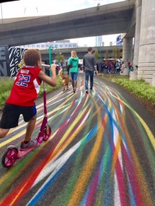
“The Big House Ballgame on April 30, which is the 100th anniversary of the naming of Route 66, featured the Joliet Slammers, a Frontier League baseball team co-owned by actor Bill Murray. It was one of the featured events of an official five-city kickoff of events commemorating America’s ‘Mother Road.’
“Baseball was also part of the prison’s history. In the early 20th century, inmates formed teams and played games against one another and against outside clubs, part of a broader effort to impose order and routine within the prison. The Big House Ballgame today is, in part, an attempt to revive that history — to connect the present moment to something that had once taken place on the same ground.
“What happened to Joliet over the past century and a half happened, in some version, to nearly every city and town along Route 66. The collapse of jobs, travel routes, and movement west – and then a slow, uncertain reinvention.
The roadway passed through working America, and then through America after the work was gone.
“The centennial is, among other things, a celebration of the survival of places that kept going when the economies that made them no longer existed.
“Curt Herron, like Mr. Williams, has lived in this part of Will County his whole life, growing up in Lockport, a small city just north of Joliet, before spending 45 years as a sports reporter covering high schools, the Slammers, and nearly every sporting event in between. Today, he’s an assistant at the historical museum.
” ‘Joliet was always a real working-class city,’ he says, pausing in the shadow of a guard tower as a group of tourists photographs the cellblock windows above him. ‘The second biggest steel city in the country after Pittsburgh. And then, on top of that, a prison city — two prisons within a few miles of each other, running simultaneously for 75 years.’ …
“The steel came first. In 1869, the Joliet Iron and Steel Works opened along the Des Plaines River, drawing on the region’s coal deposits and its limestone – the same blue-gray stone that built the prison walls, the same stone quarried from just beneath the city’s surface – to become one of the great industrial enterprises of the Gilded Age. At its height, it employed thousands of men and produced the railroad rails that stitched together the American West.
“Joliet drew immigrant workers in successive waves: first, the Irish who dug the Illinois and Michigan Canal in the 1840s; then Poles, Lithuanians, and Eastern Europeans; then African Americans and Mexican migrants during the First World War. Joliet became, in the language of the era, a city of stone and steel – proud of its grit and defined by its labor, built on the conviction that hard work in a hard place was its own kind of American story.
“Then, the steel left. By the early 1980s, the mill was gone, and the unemployment rate in Joliet climbed to 26% – among the highest of any city in the United States at the time. The limestone ruins of the ironworks sat empty along the river for decades, overgrown with vegetation, before the Forest Preserve District turned them into a heritage trail. A wound, converted in time into a park.
“ ‘We were known for being a hardscrabble place,’ Mr. Herron says. ‘Because of the prisons and the steel industry and a lot of working-class people. But that’s not a bad thing. It’s also led to a real competitive area – a lot of great athletes have come from here, a lot of people who’ve gone on to do remarkable things.’ ”
More at the Monitor, here. No firewall. Consider an inexpensive subscription.


